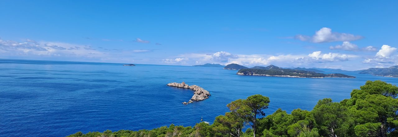
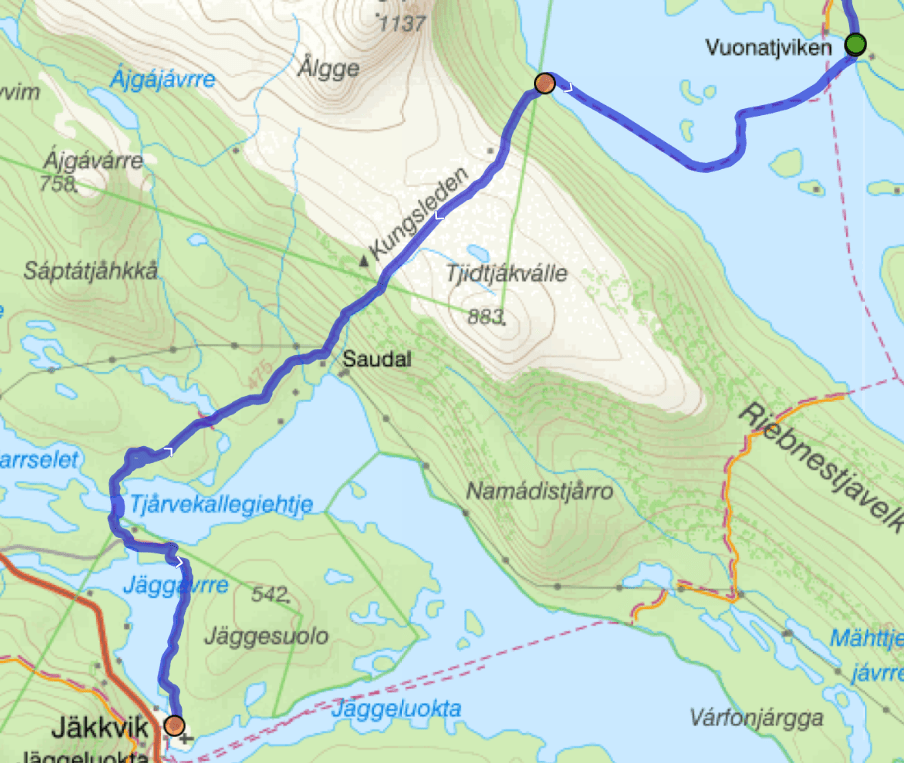
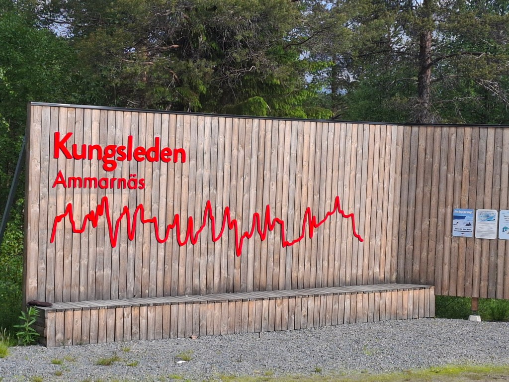
A 470km adventure through Swedish Arctic wilderness
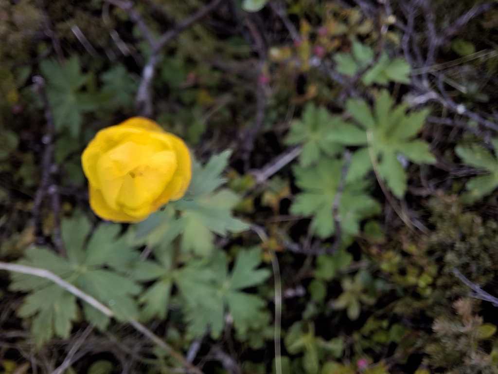
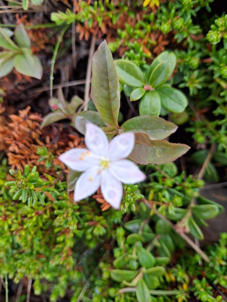
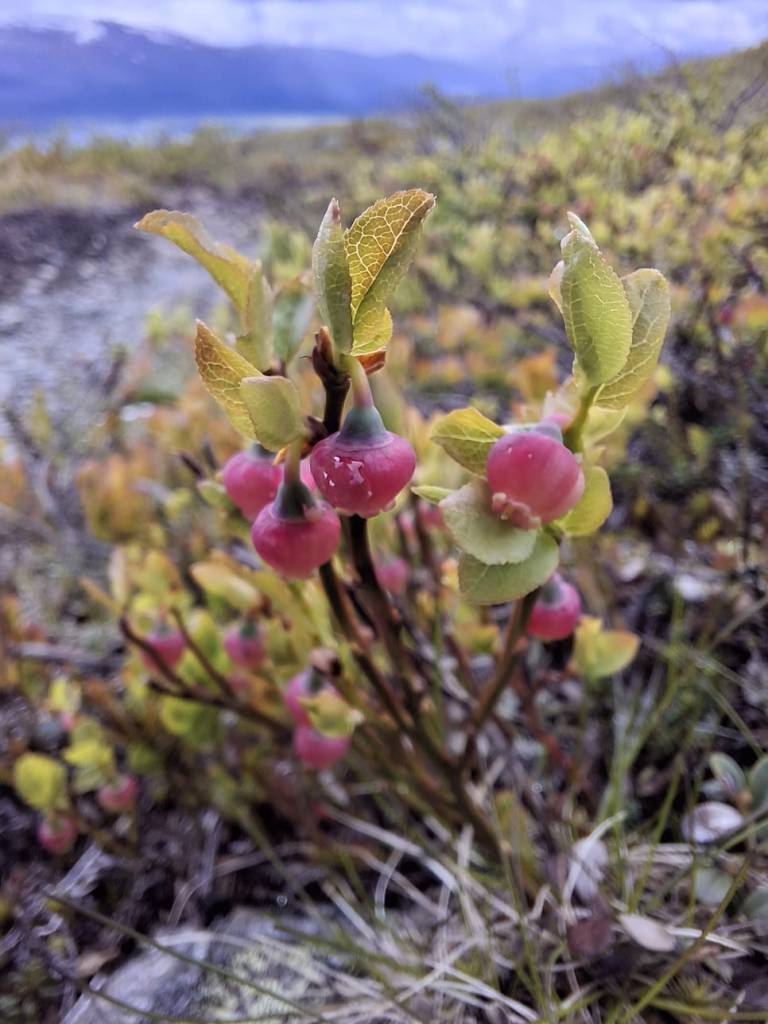
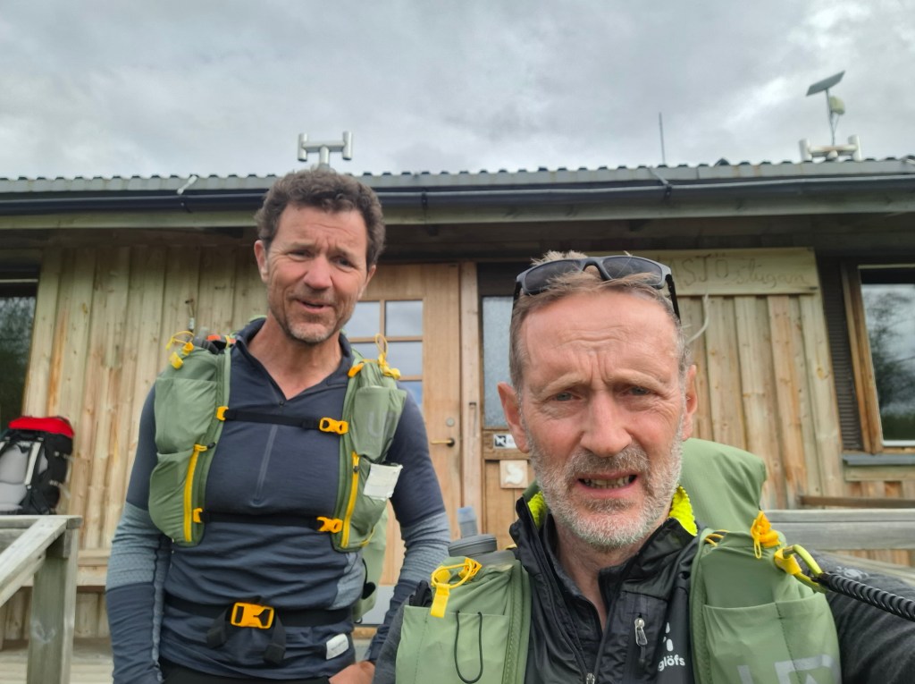
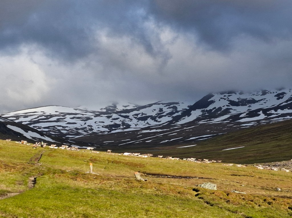
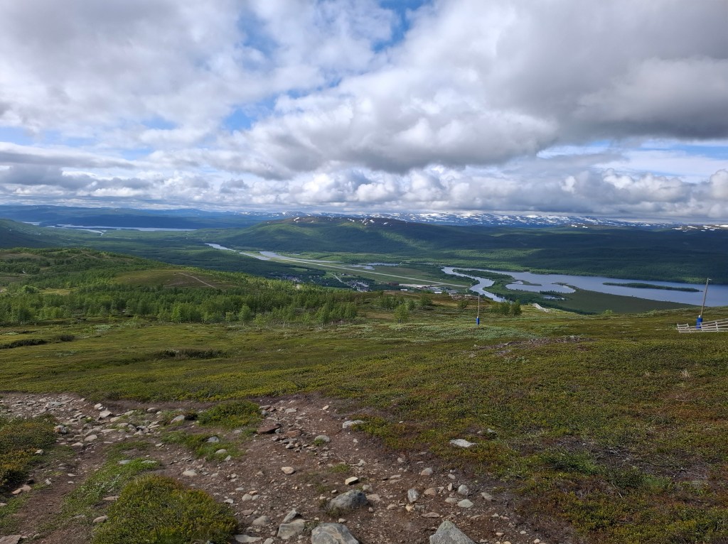
Cammie Kennedy and I finished Kungsleden mid-morning on the 14th day. In the end it all worked out as planned. Approximately 450km on foot plus 7 water crossings totalling 20.2km. 8,840m of climbing and almost the same descent. Everything on a grand scale – snow fields, intimidating looking snow bridges, raging torrents of snow melt, dark foreboding mountains, massive delta plains, 24 hour daylight, alpine like meadows with delicate flowers, reindeer, big, big skies and millions of mosquitoes and ants. We are thankful to all who prayed for safety and the strength to complete this epic trail.
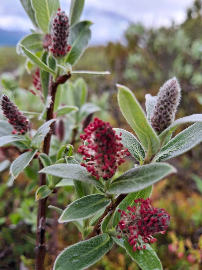
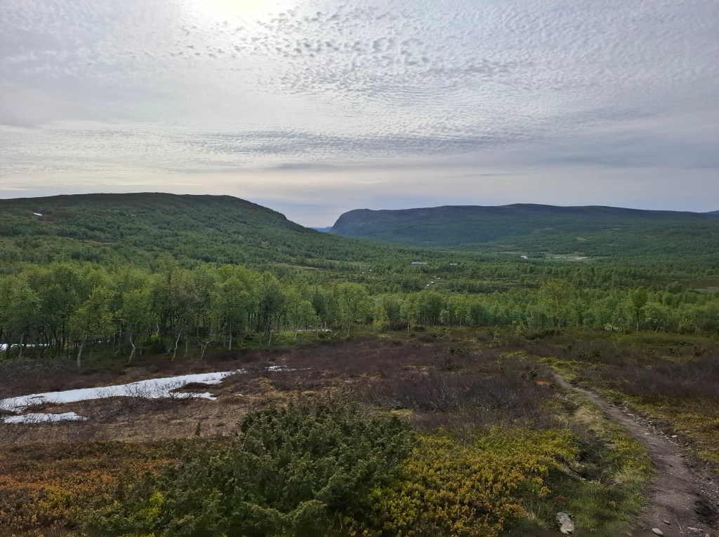
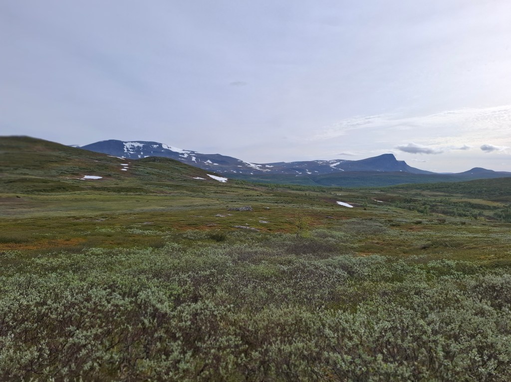
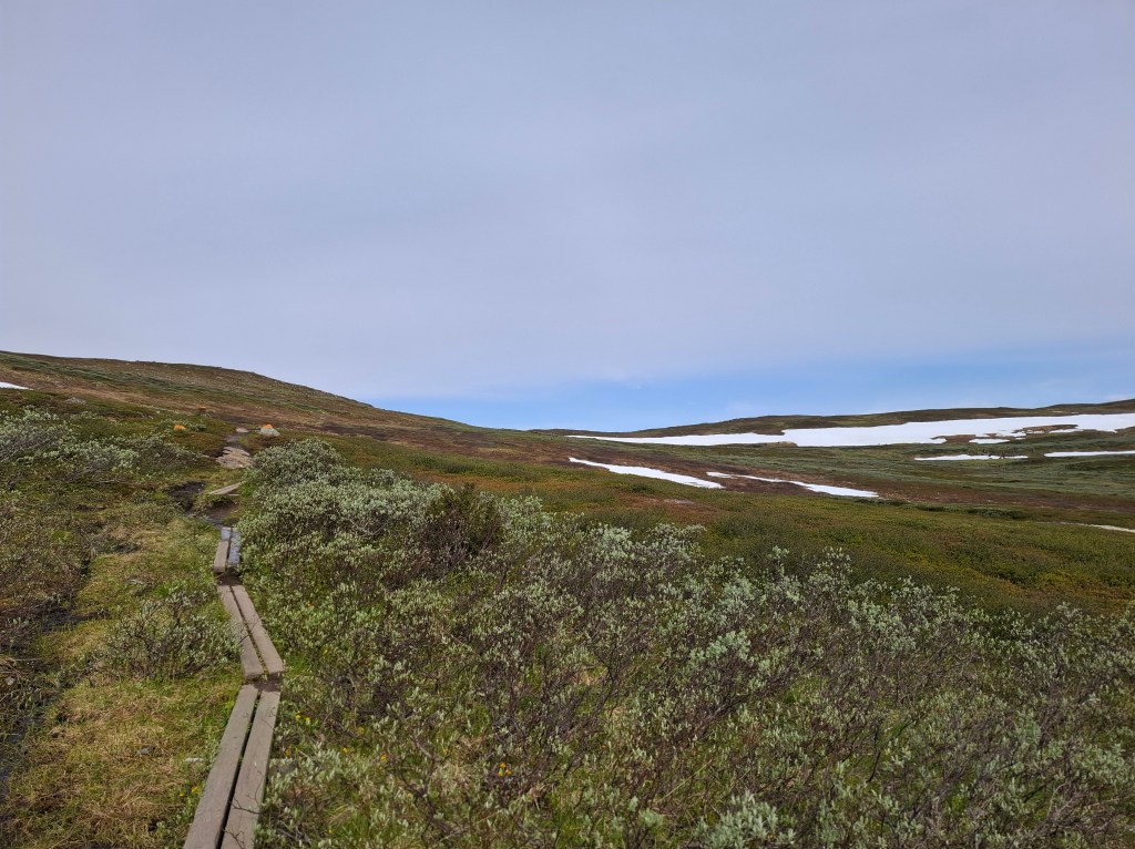
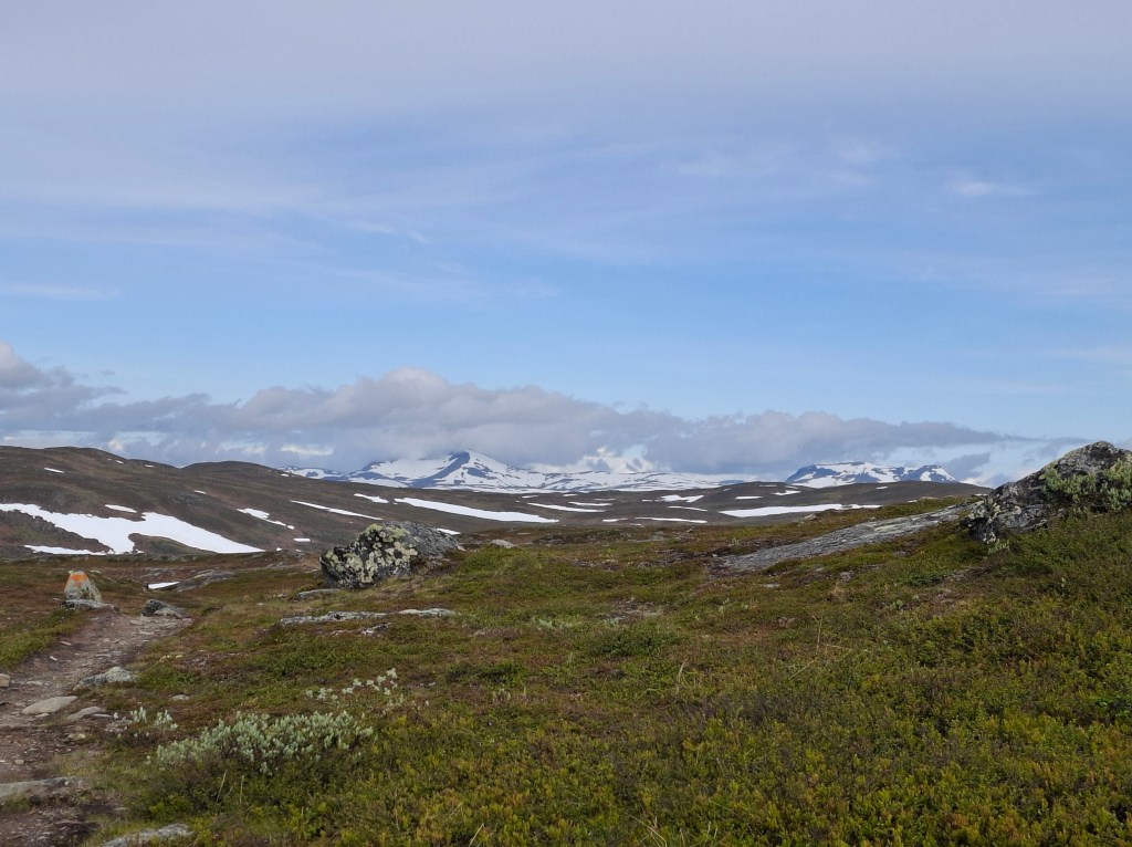
14 days of intense physical and mental effort is difficult to summarise in a handful of paragraphs. The overall experience has merged in many ways into a continuous block of time. Aided no doubt by the continuous daylight. Hard to distinguish each day separately. However I attempt below to relate each day as it came. They include some recollections and pictures, often of the incredible landscapes we were moving through. Most of the photos are taken by me but also a number from Cammie, especially flowers. Majority of pics are chronological but a few are mixed up. My narrative is also peppered with impressions that more often than not belong to the whole experience rather than any particular day.
Swedish Tourist Association (known in Swedish as ‘STF’)
We were dependent on their wide network of huts, emergency shelters and more that STF have established. STF is an outdoor, charitable organisation that has pioneered in making wild and remote places accessible. It was a privilege to meet those who have lived their summers for many years in places with no running water or electricity. There to serve those passing through. STF have in most places set up the different stages of the route. We both took membership of the organisation. This affords 20-30% discount on their accommodations and even train travel in Sweden. Only takes about 3 nights accommodation to pay for the subscription.
Getting to the start
We flew to Stockholm and then took a flight to Kiruna. This town is the location of the biggest underground iron ore mine in the world. Mining has taken place for over 100 years. All that digging has caused problems with the town sinking. A novel solution is being undertaken by physically moving parts of the town so they can keep digging!
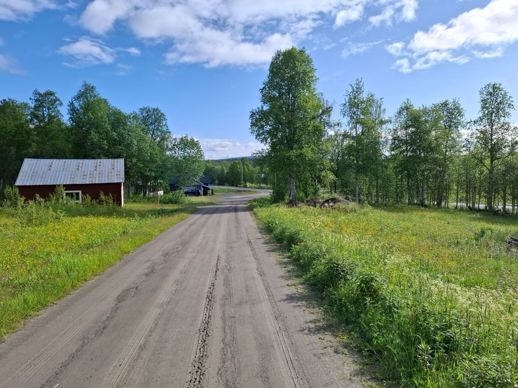
From Kiruna airport we took the once a day bus that goes to Abisko. Important to ensure plane connects with the bus time if you don’t want to pay for expensive taxis. In Abisko we stayed overnight at the STF Fjällstation which is located right beside the start of Kungsleden (hereafter called ‘KL’). It seemed quite busy but not sure how many were actually resident as we had a 10 bed dormitory to ourselves.
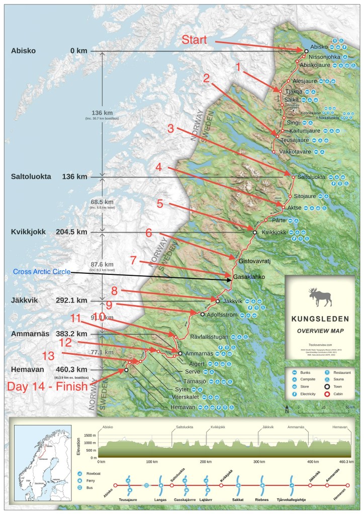
Route Summary
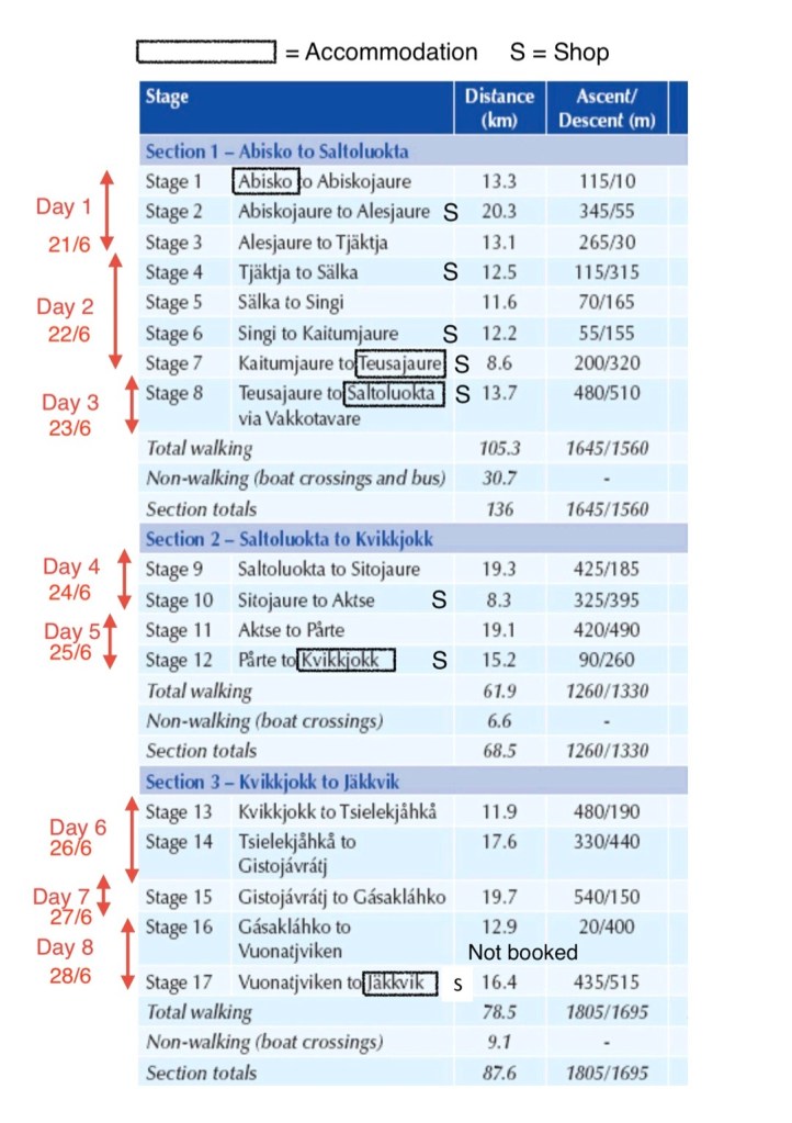
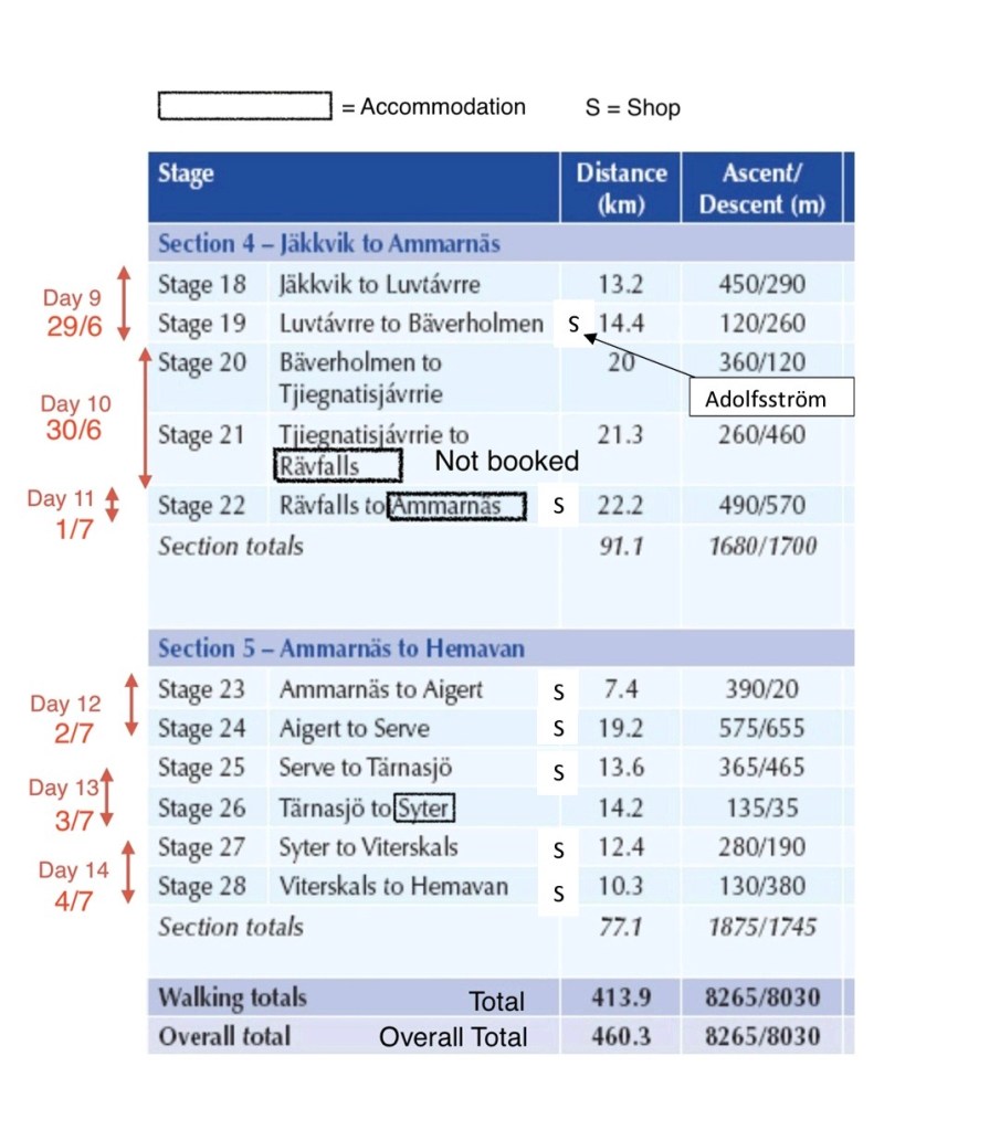
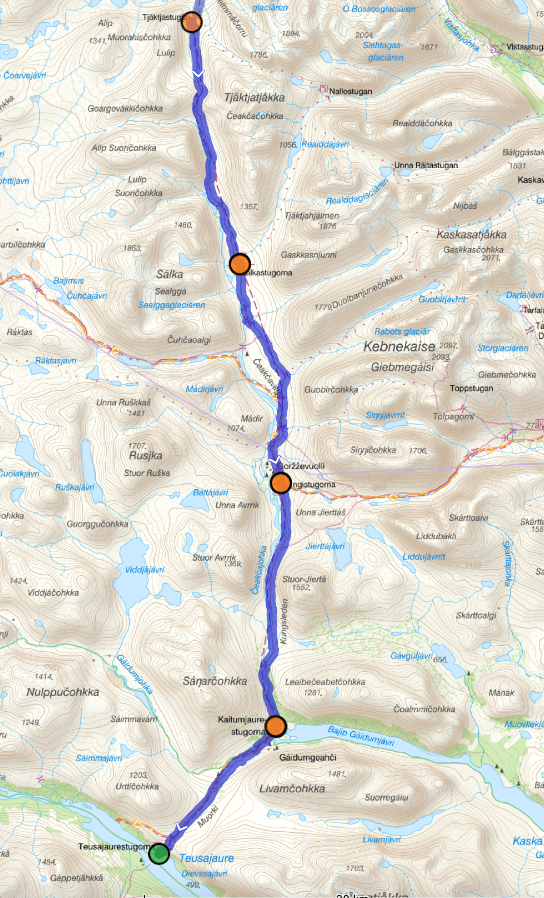
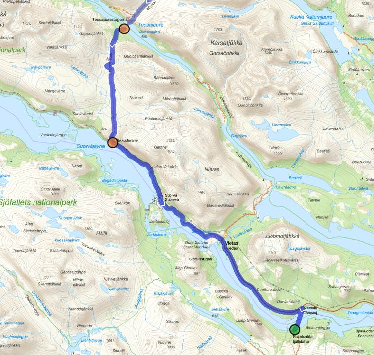
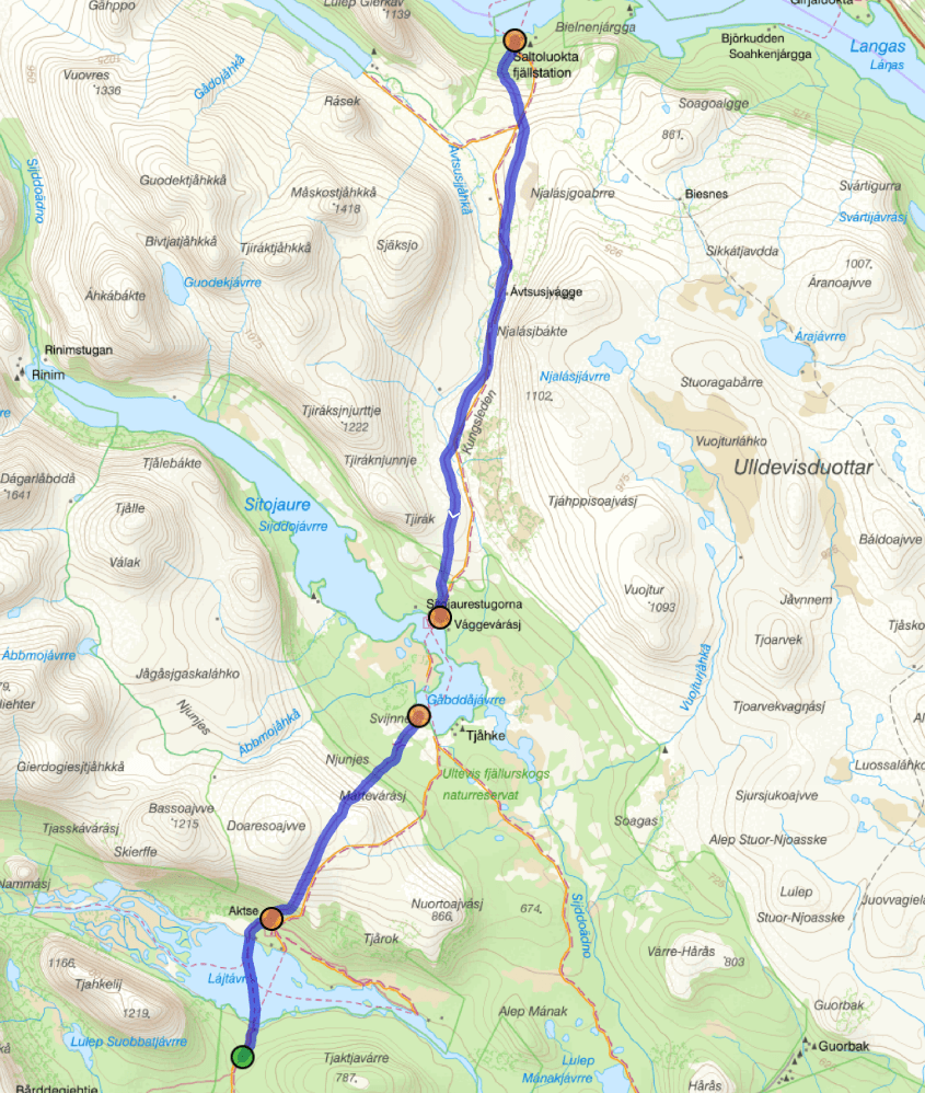
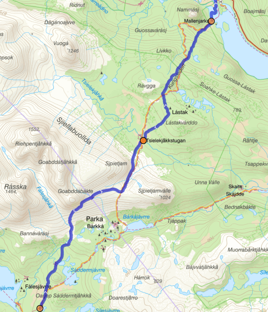
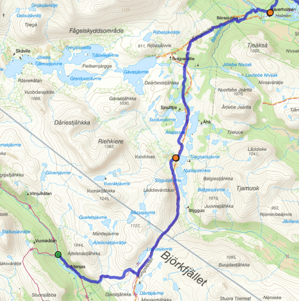
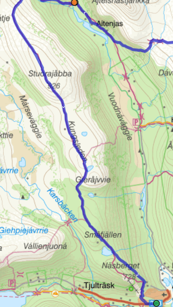
The tables below are taken from the English guide book ‘Trekking the Kungsleden’. It was helpful and informative in giving an overall feel for the trail. However it was first published in 2018 and a number of facts and details are out of date. In particular the distances do not correspond to actual distances or the signposted route distances. Estimate there is about 20km discrepancy. The distances shown on each day were recorded on Cammie’s GPS watch. The total came to 448km which he estimates was a few km short due to forgetting to record.
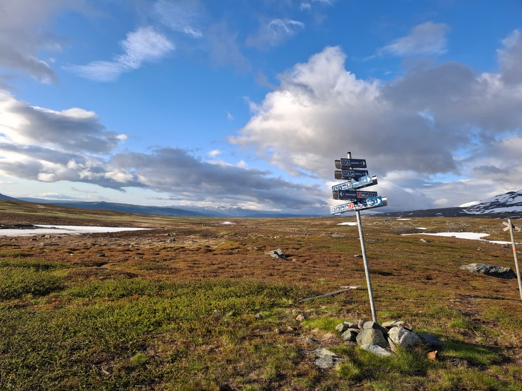
We had decided to do the route from north to south. It turned out that at midsummer that was unusual. The majority of folks we met on the trail were going south to north. These sensible people were hoping that by the time they got to the far north it would be warmer. In the whole 2 weeks no one passed us and only on one occasion did we overtake anyone. Most of those we met were just doing part of the trail, usually joining and finishing at the trailheads where there was access in or out by road. The whole route comprises of 28 stages broken into 5 sections. Beginning and end of each section there were trailheads, usually small communities of only a dozen or two permanent residents.
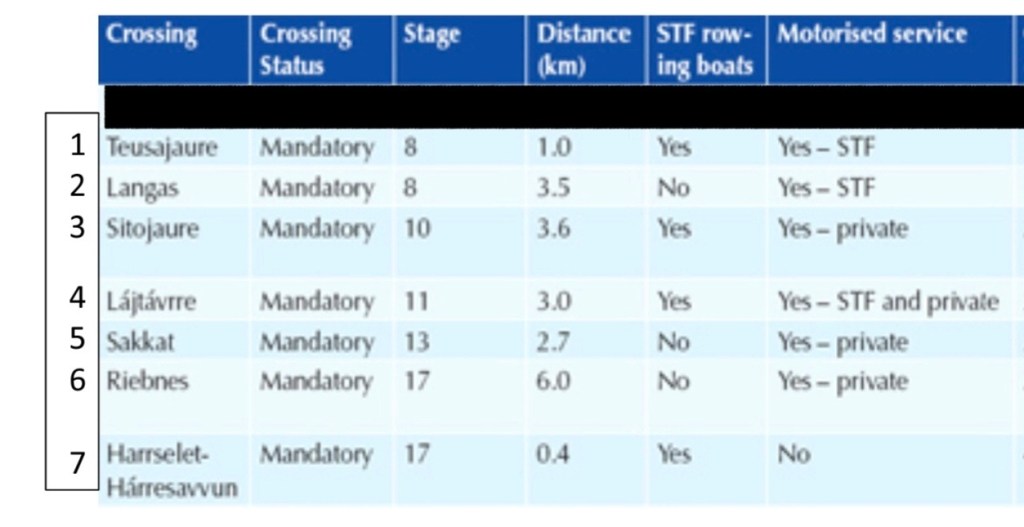
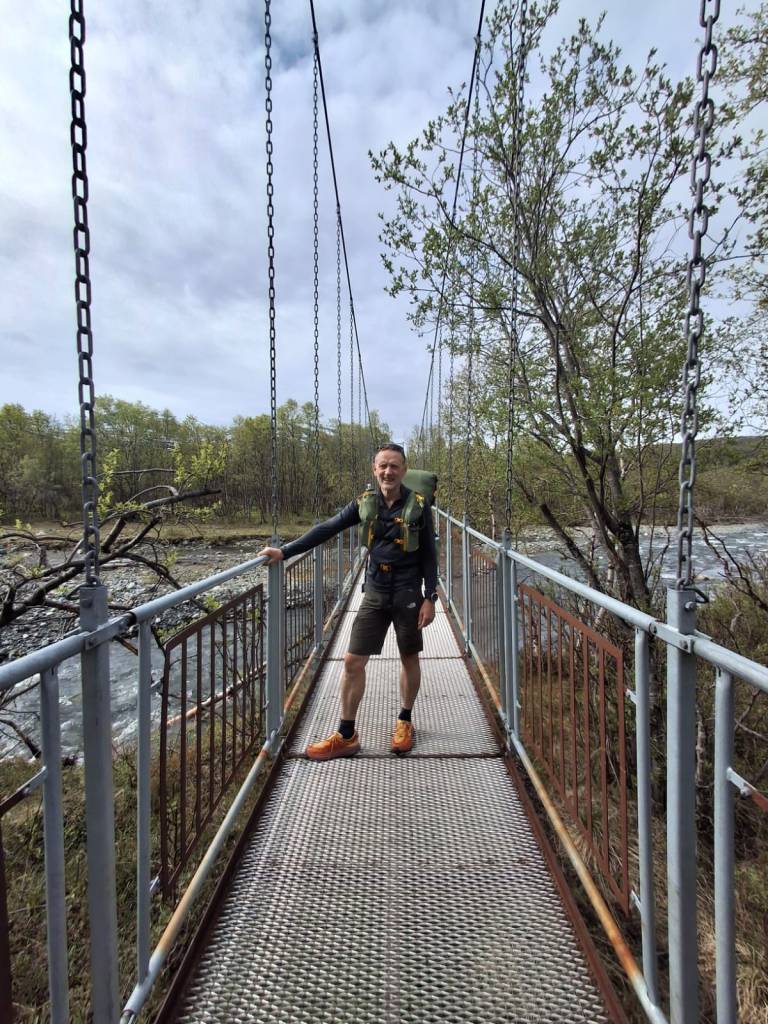
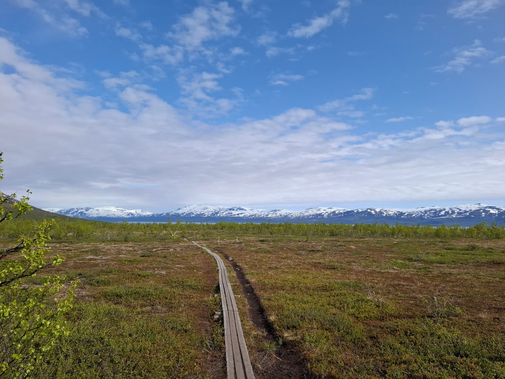
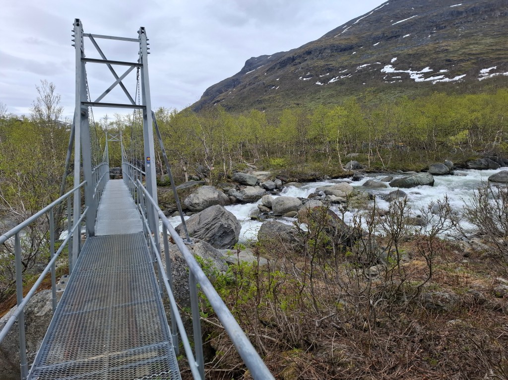
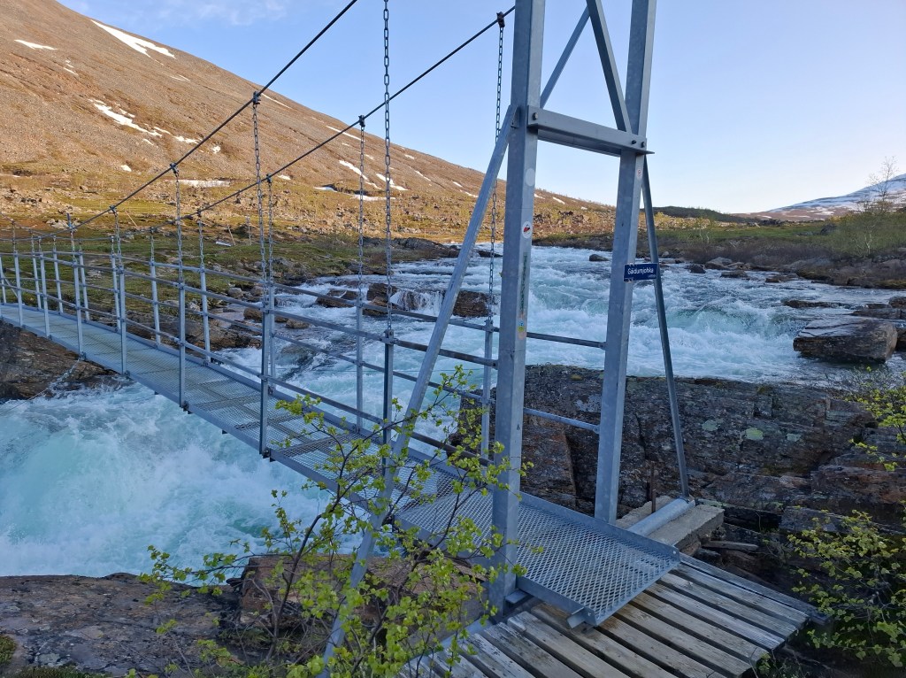
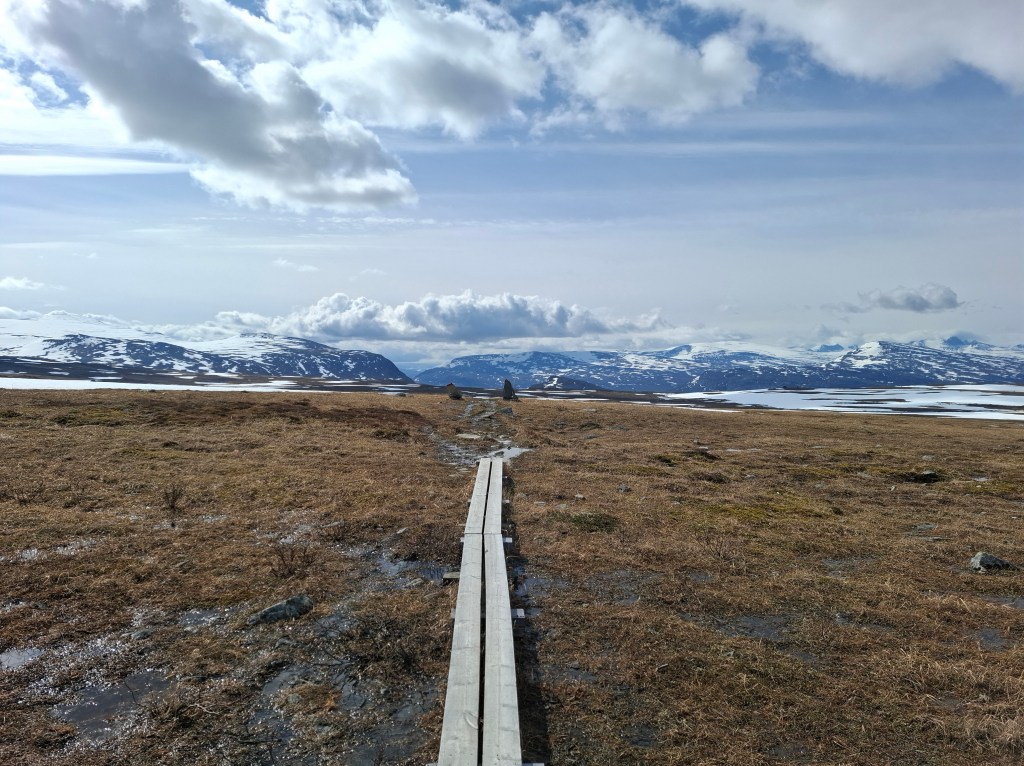
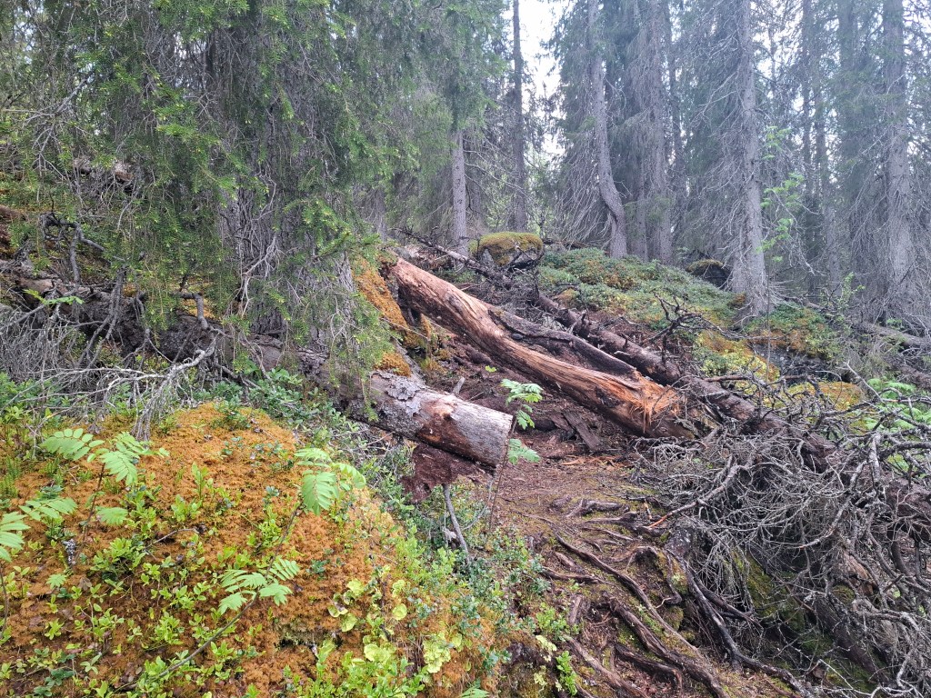
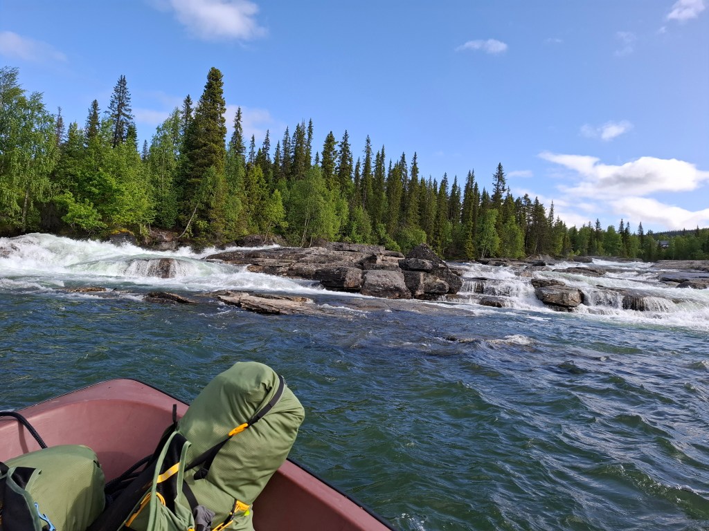
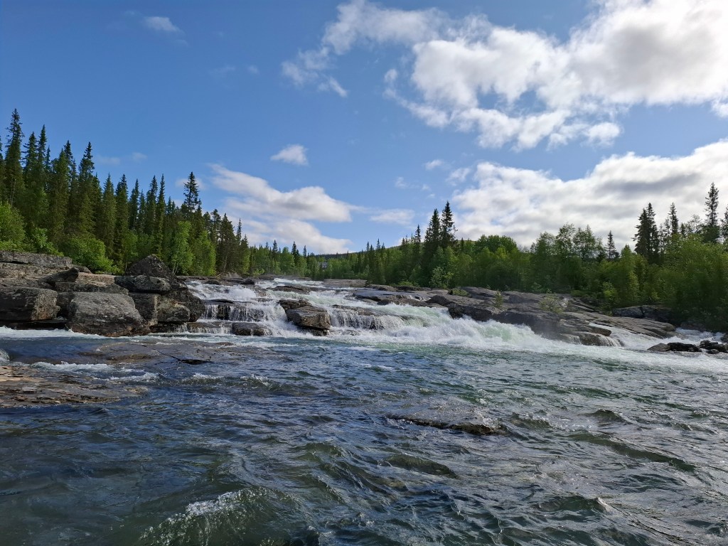
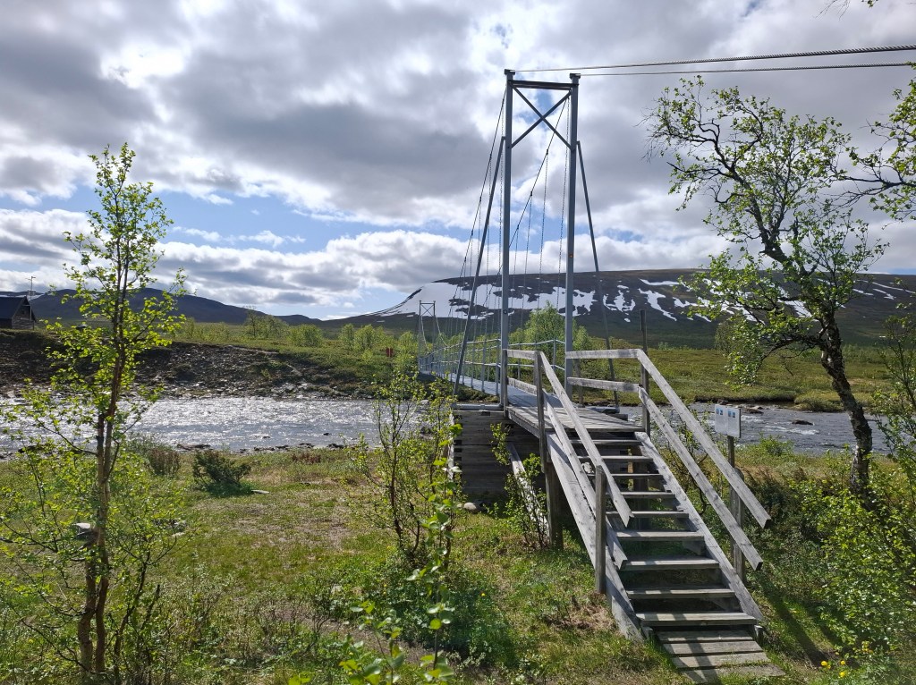
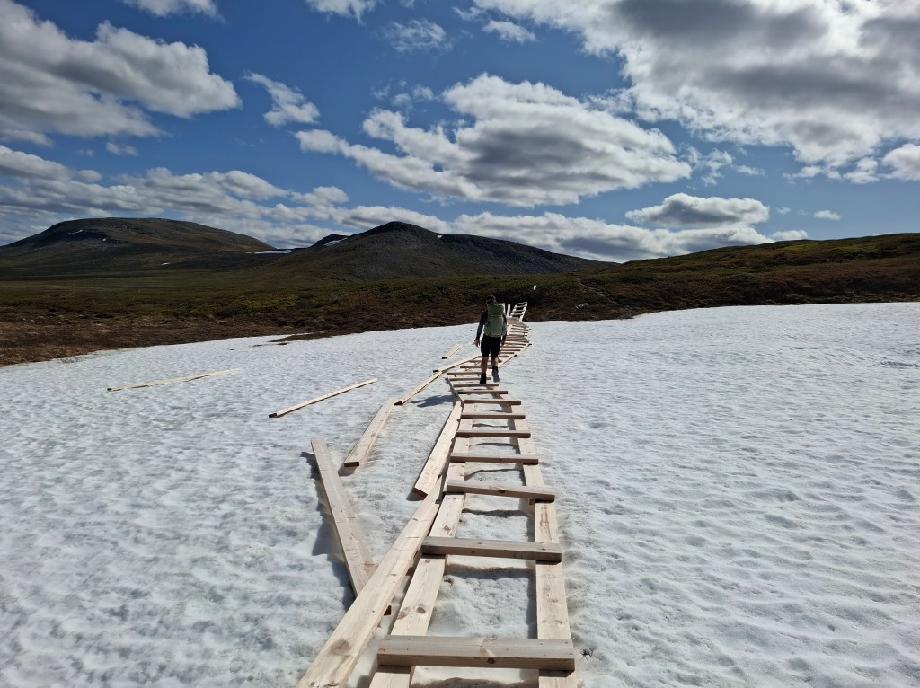
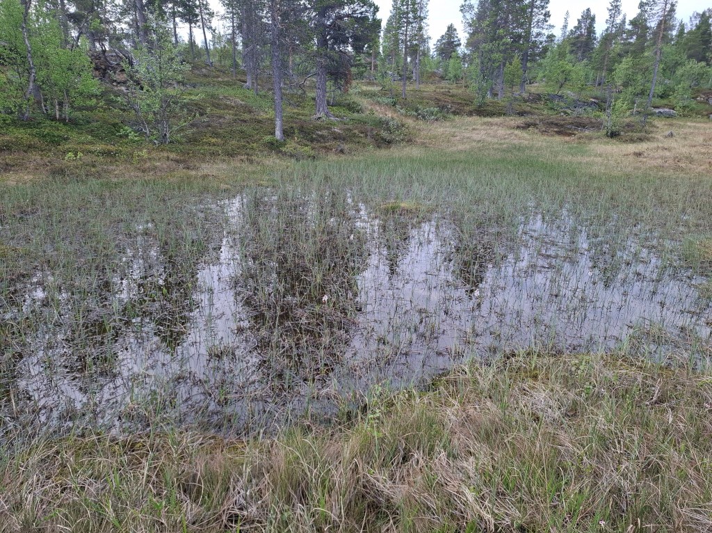
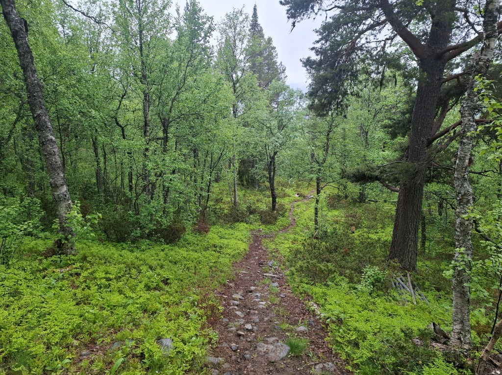
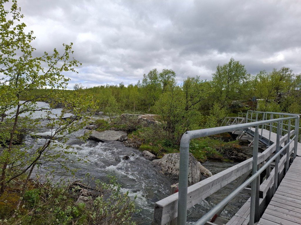
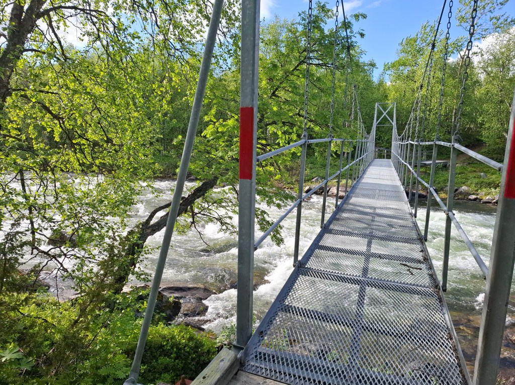
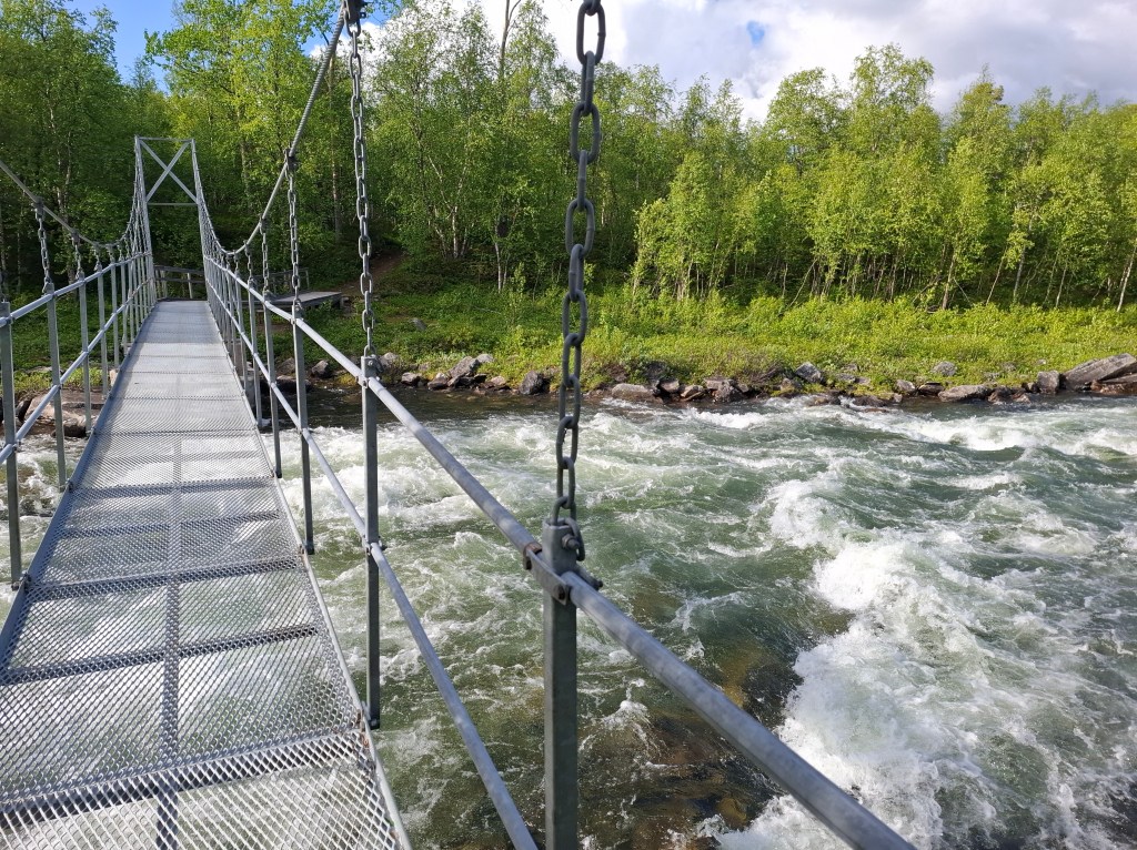
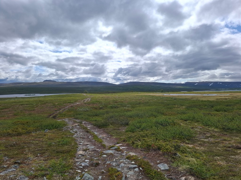
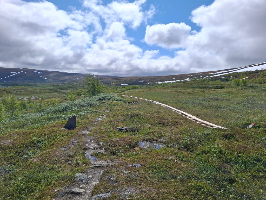
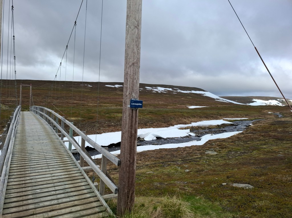
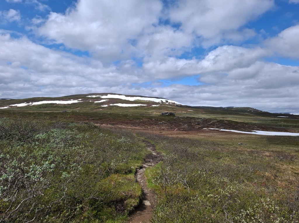
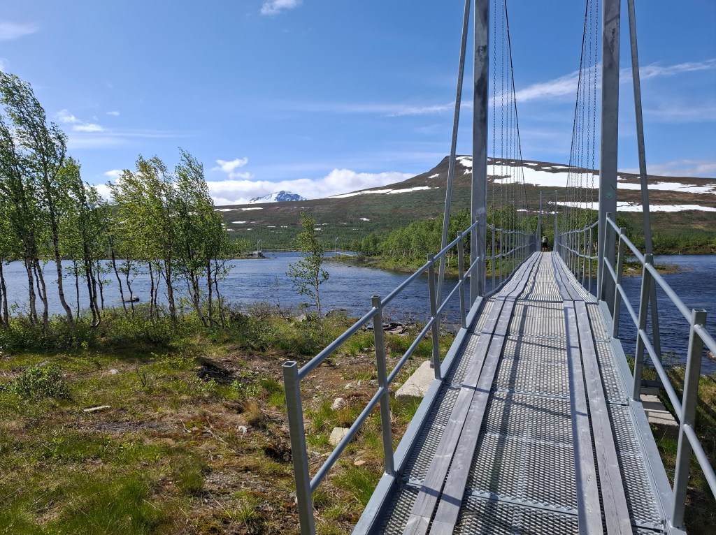
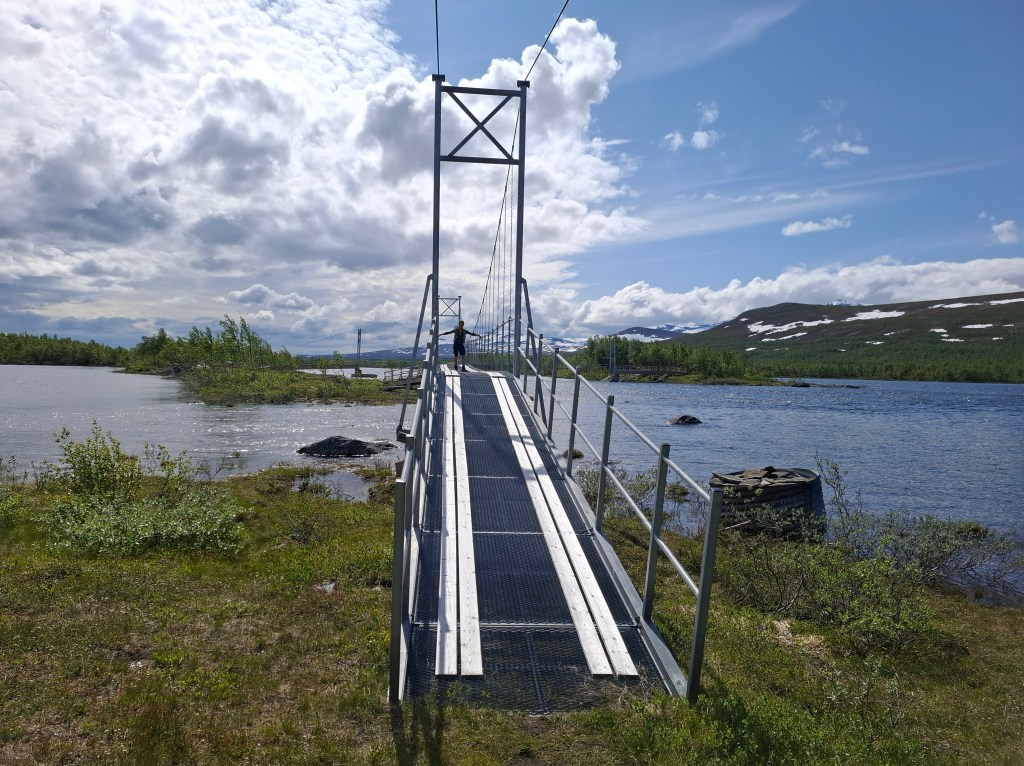
Some may wonder why a trail has 7 mandatory water crossings. I did too thinking that you could go round lakes or waterways. Little did I appreciate the fact that with massive snow melt most of rivers and streams were powerful and impossible to cross by foot. You have to use the boats and ferries as well as many foot bridges. Other infrastructure included an extensive network of duckboards which made traversing bogs a lot easier and quicker. Duckboards are wooden planks nailed together.
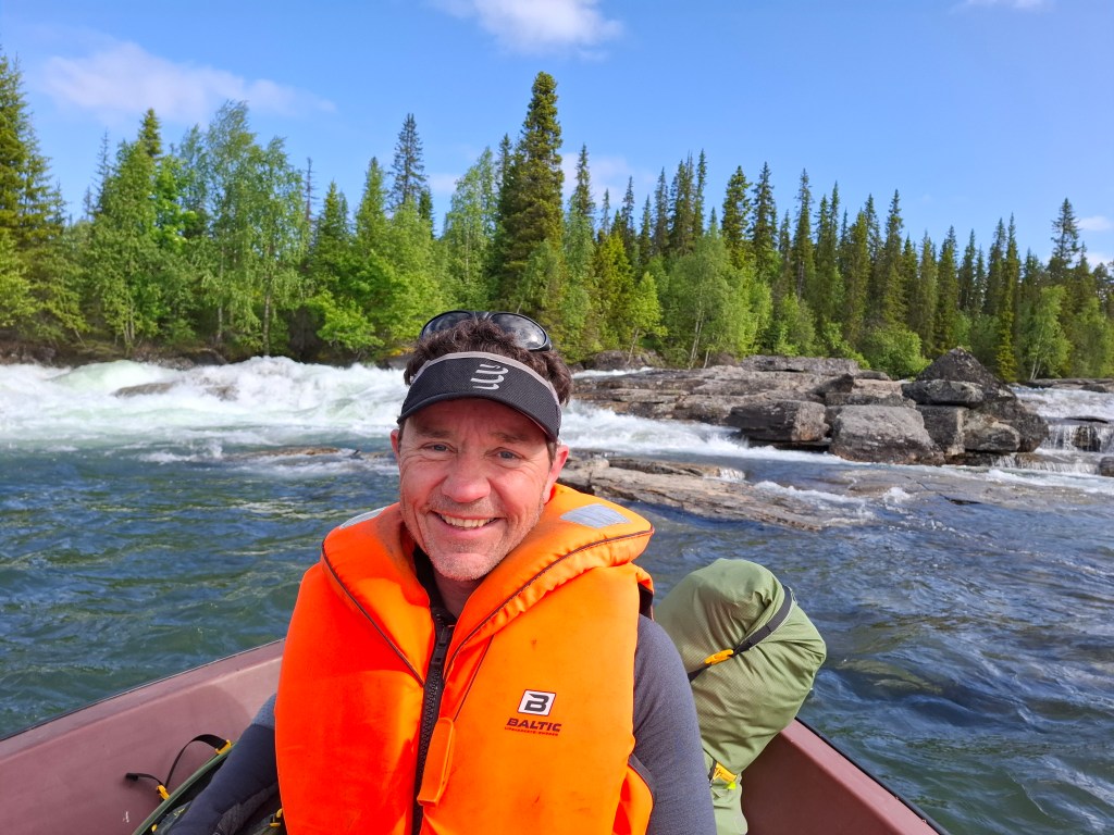
FERRY AND BOAT CROSSINGS
Navigation and Safety – we both used Topo GPS maps on our mobile phones with paid for premium features for Sweden. The maps shown for each day are screenshots from Topo GPS. To save power most of the day our phones were in flight mode which still allows GPS to function. Phone coverage was very unpredictable. Cammie also carried a Garmin InReach 2 GPS satellite tracker. Emergency services could, if needed, be called by just pressing a button. It also allowed preset messages to be set at the start and end of each day to loved ones. In addition there was a feature where others could track our location throughout the day through a website. As power backup we also both carried solar chargers/ power banks.
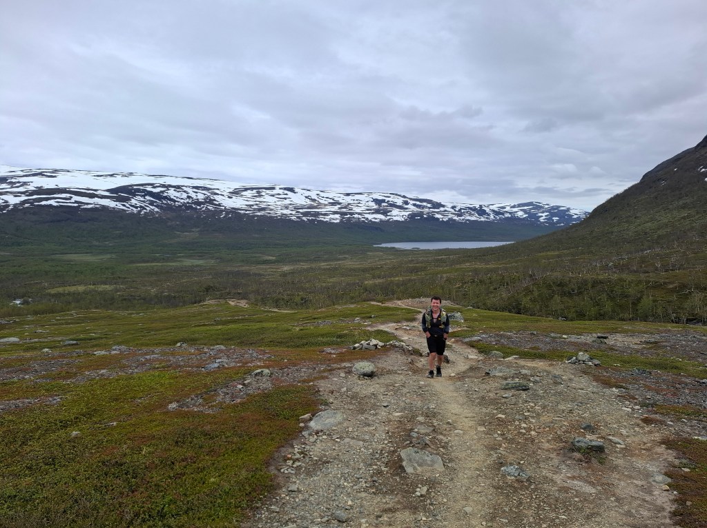
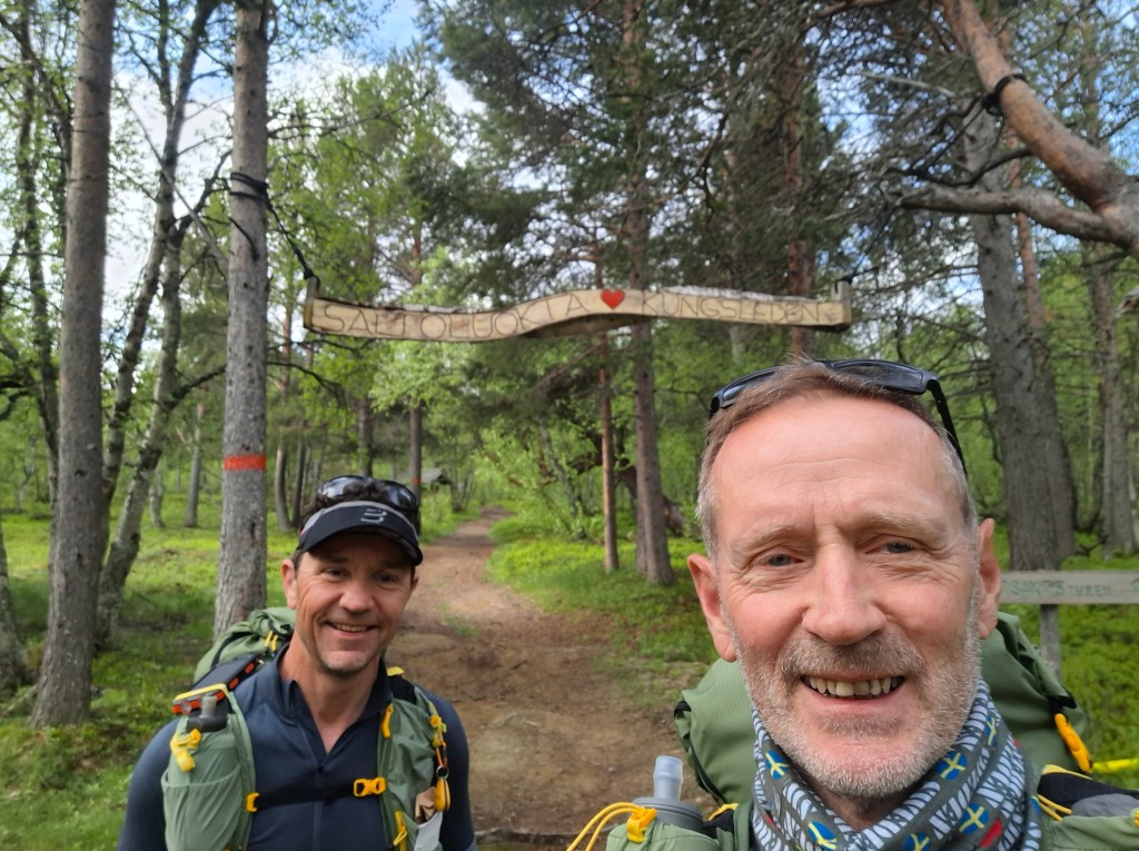
DAY 1 Saturday 21st June 54.80 km. Abisko – Tjäkta
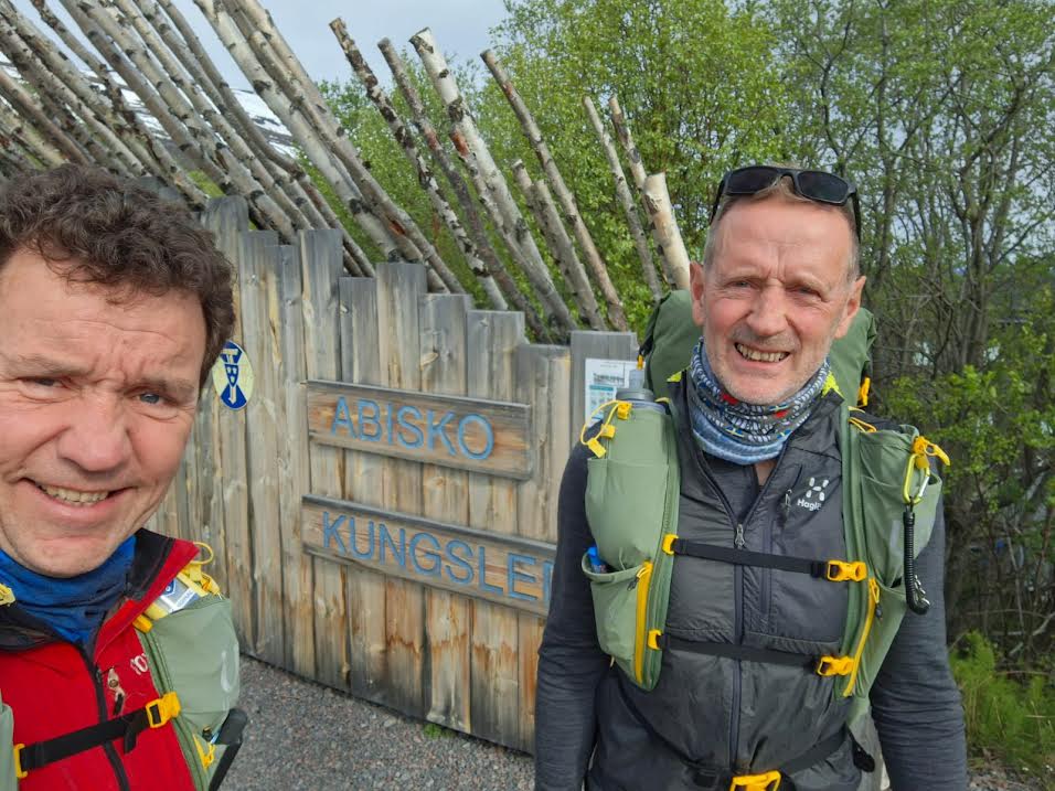

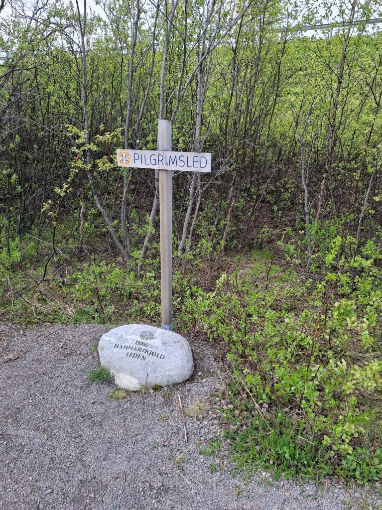
We had a hearty buffet breakfast in the fell station. Didn’t know when we would next get such nourishment so think we both really got our monies worth! Then, in high spirits, we proceeded to the start of KL a mere 100m away. Conditions seemed very springlike with greenery and sunshine. I did glance more than once to the north and the frozen looking mountains. Glad we were heading south. We set off about 0820 following the mighty Abiskojåkka river. The trail in the beginning paralleled the Dag Hammarskjöld pilgrim way. Cammie posed at one of the meditation stones and we carried merrily on our way. The trail seemed very well marked. After an hour we came to a road! That was not in the plan. It turned out we were back at the start!! After posing for pictures we had followed the winter trail markers which looped back to Abisko. Talk about managing expectations! We had just ‘wasted’ 5km and had to start over. From then on we were very careful to follow the right markers.
Start again. This time in a more subdued mood and personally annoyed at seemingly expending energy for nothing. We had just added 5km to our distance. As in life some things have to be put behind you and just press on. Fretting about it would be of no help.
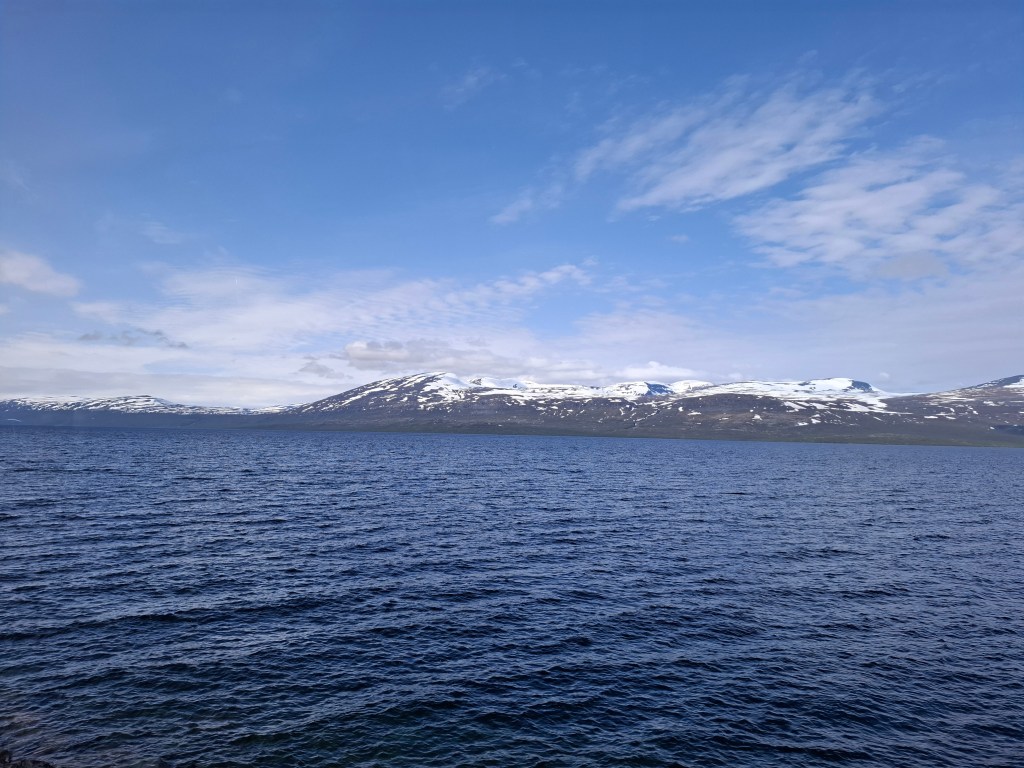
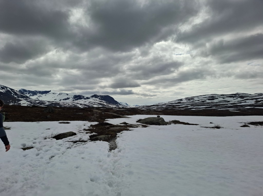
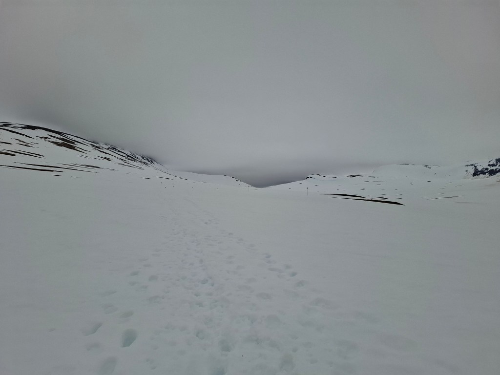
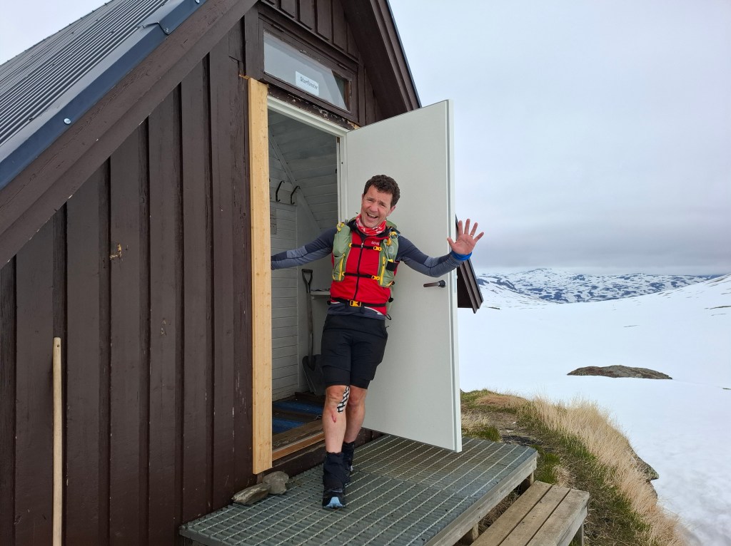
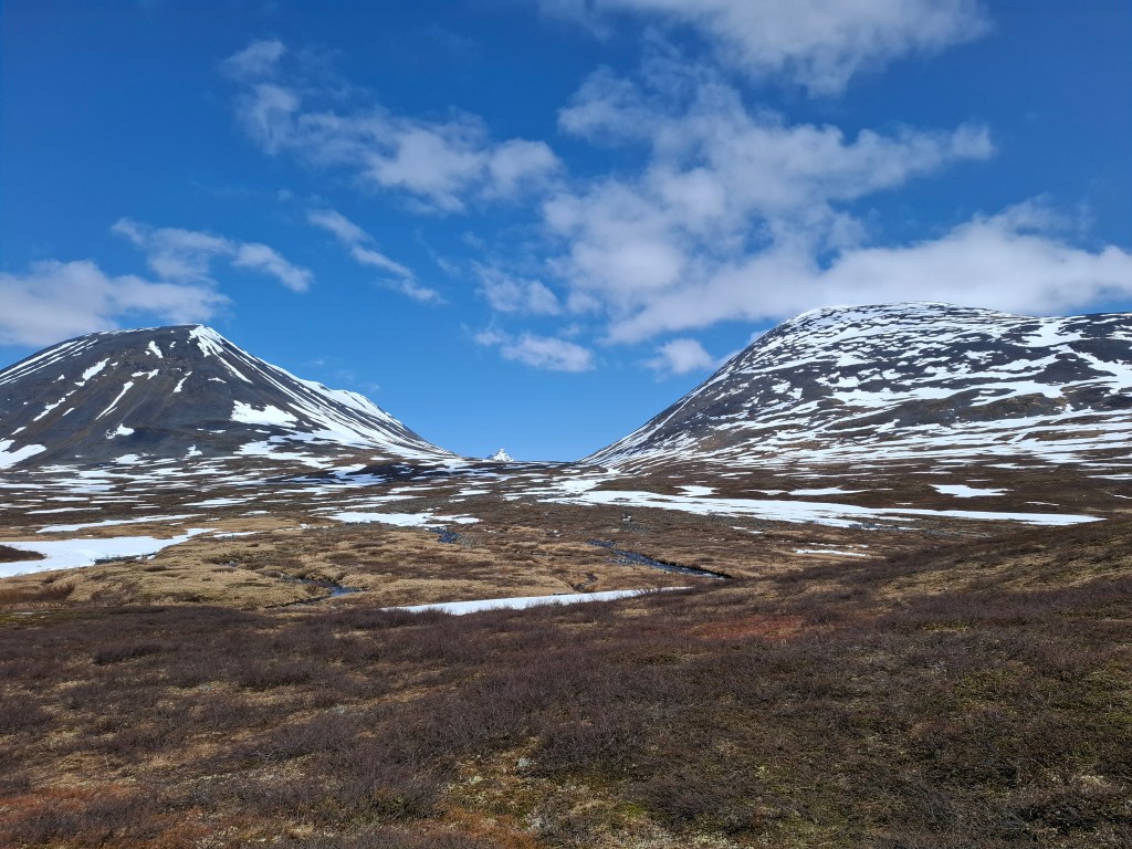
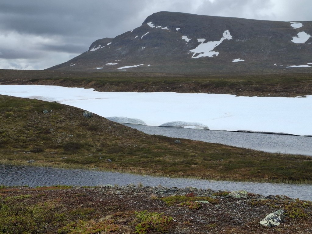
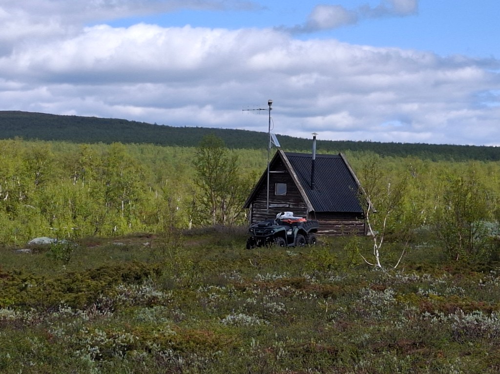
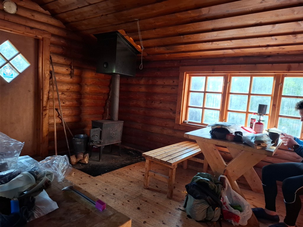
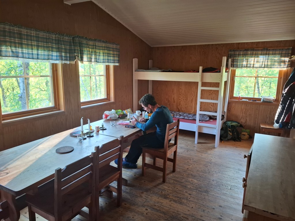
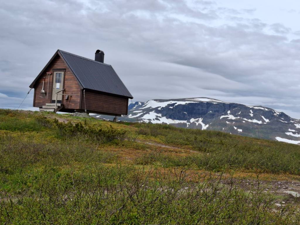
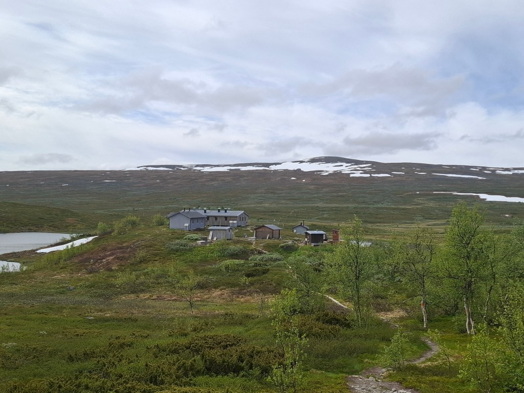
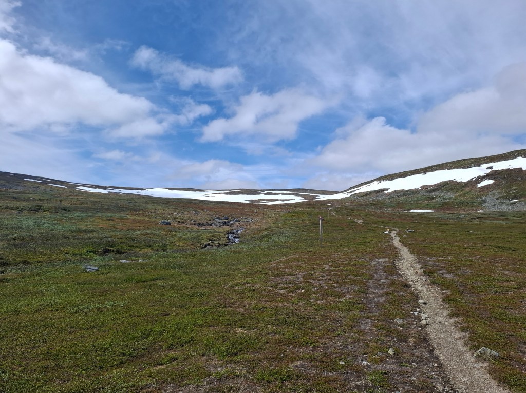
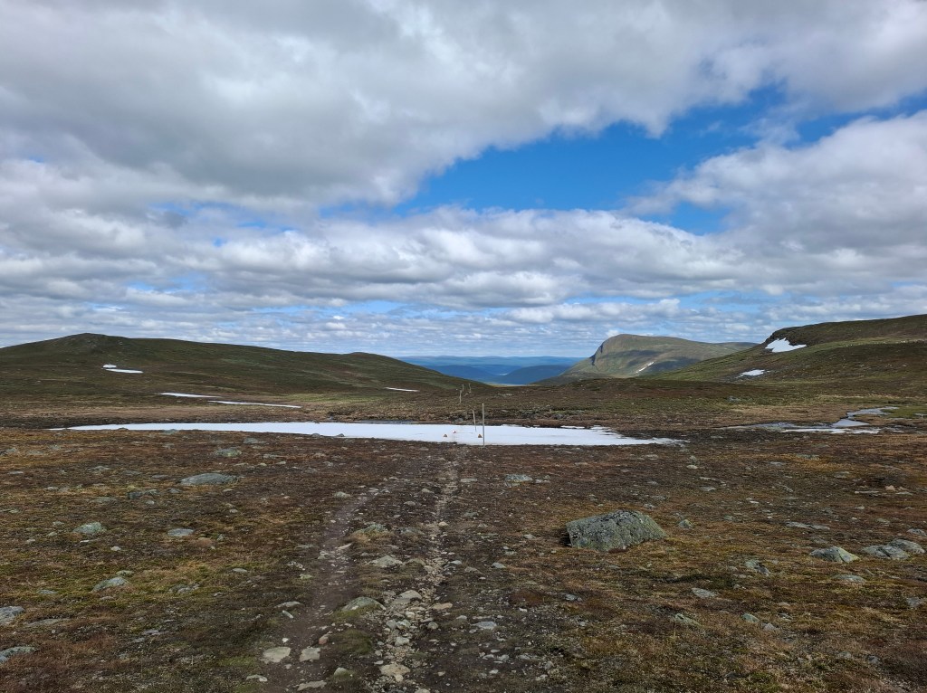
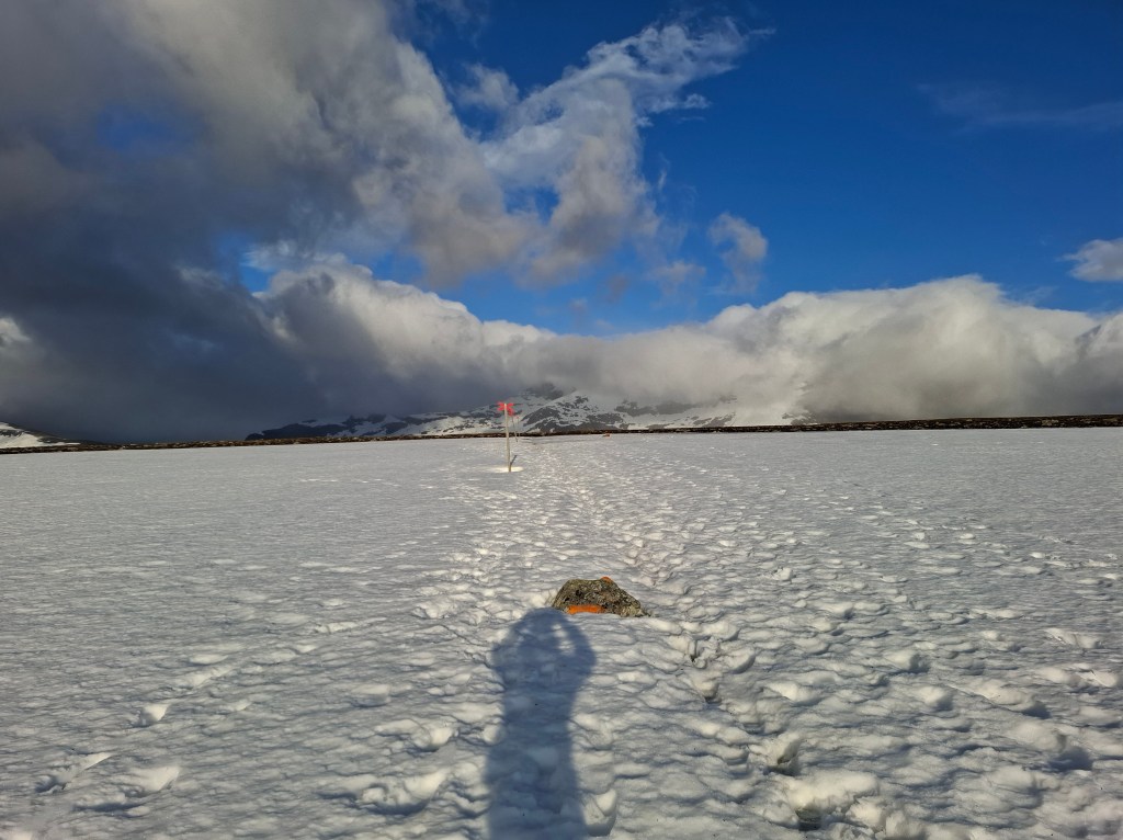
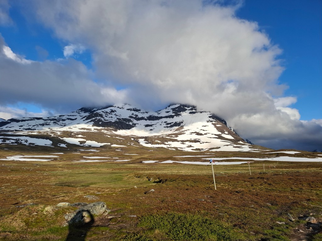
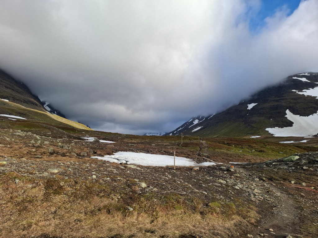
Before long the trail started to be covered by snow. Lots of it. It was not snowing but the late spring snows had not melted as they usually do by midsummer. We soon found ourselves in wintry conditions. Yet not like Scottish wintry conditions. The sun reflecting on the snow often made for intense heat, almost sauna like. The conditions slowed our pace considerably. We were also climbing. Our aim was to get to Tjäkta STF hut at the end of day. After some 13 hours we arrived at our destination. Wonderful to get inside and make use of the kitchen. As is the norm with STF huts there was no electricity or running water. The latter being taken from streams or rivers nearby. However the huts usually have gas stoves and wood burners.
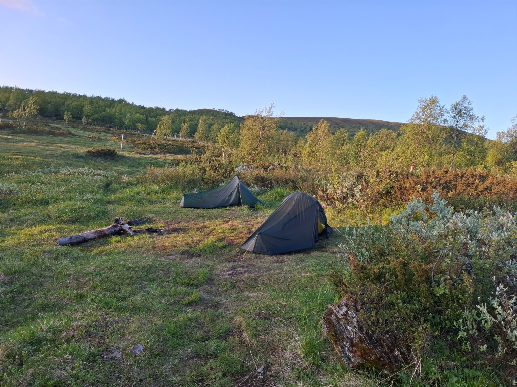
We were given a tent pitch outside the kitchen right beside a wall of snow. It felt like sleeping at a fridge door! By 3am I decided I had had enough of the cold and opted to go inside the hut and sleep on the kitchen floor. Cammie blissfully slept on. He loves camping whereas, for me, most of the time it is a means to an end.

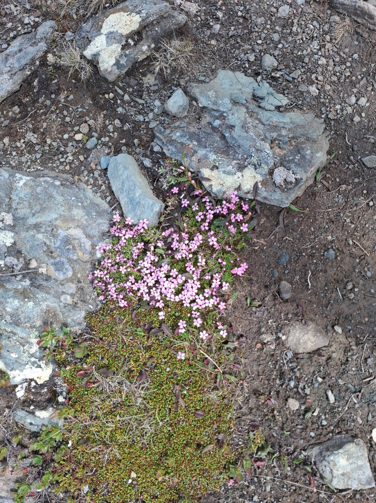
The bright sun moved around us in a great circle. I imagined it behaving like a great halo, as if God was blessing and sanctifying the world below. Practically, we were grateful for our wrap around eye masks. With no sunrise or sunset the passage of each calendar day was blurred. The only cue was perhaps a weariness in body. The continuous light seemed to energise everything. Even with eye masks there was a sense that you were being suffused with light. As Cammie pointed out everything living here had a 3 month window of opportunity. All were in a frantic race to grow and reproduce. 24 hour daylight seems to aid and abet this process.
DAY 2 Sunday 22nd June 47.12 km. Tjãkta – Teusajaure
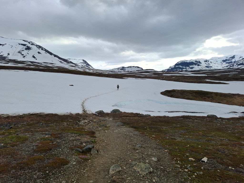
Starting off about 0800 we set off over the snow fields. This turned out to be an even longer day, 15 hours. Our plan had been to cover 7 stages in the first 2 days which was for most a week’s hike. We knew this but were hoping that the days following would be easier. However we hadn’t reckoned for tramping through so much snow. In retrospect these mega first 2 days did make for shorter days subsequently and was probably best to do in the beginning.
We continued our climbing from previous day to the highest point of KL, Tjäkta pass (1150m). Passing a few people who were struggling in the snow I had a brief chat with the man. Soon we reached the top of the pass and the emergency shelter. The snow all around disoriented me and after looking around the emergency shelter I took off downhill. This was only to meet the same man I had passed earlier. I had gone back the way I had come up. It was only a few hundred meters ‘wasted’ energy but that was second day in a row with a navigation error. Thankfully there were no more in subsequent days!
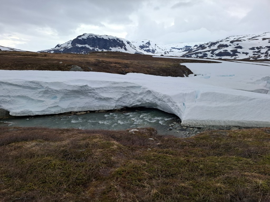
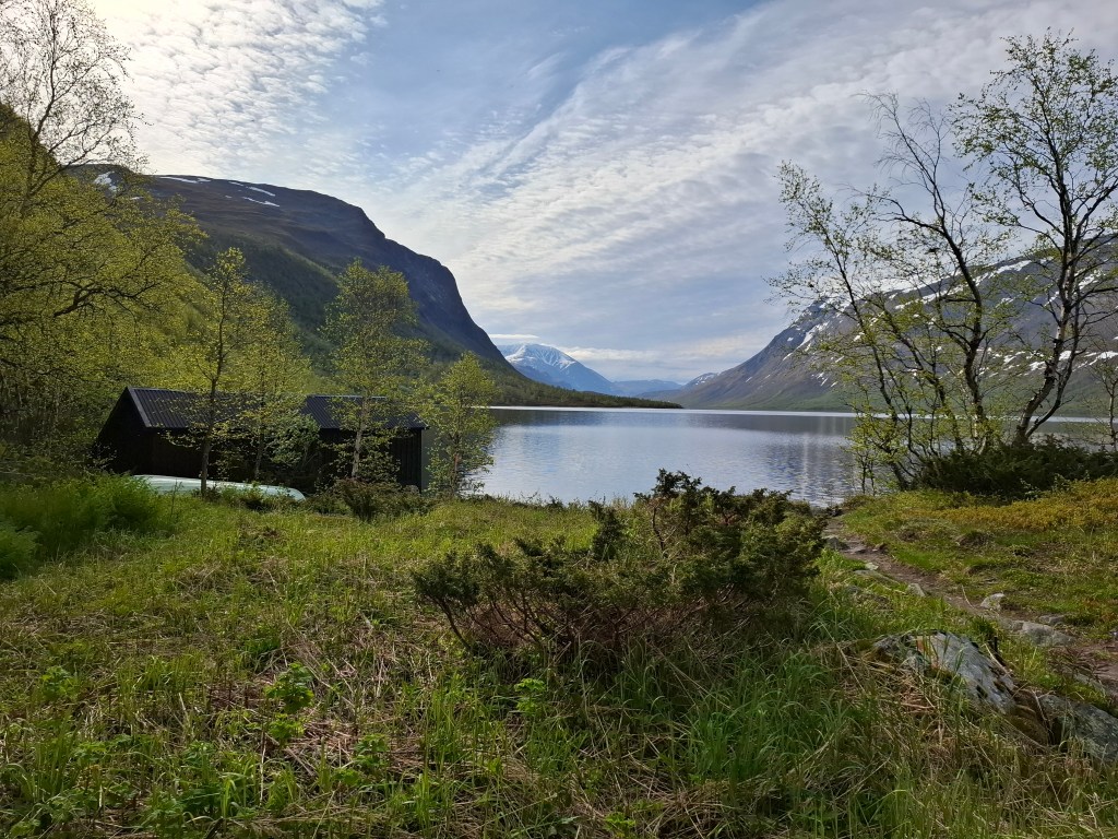
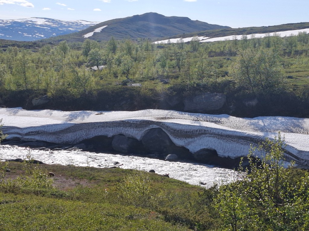
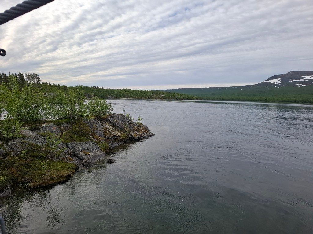
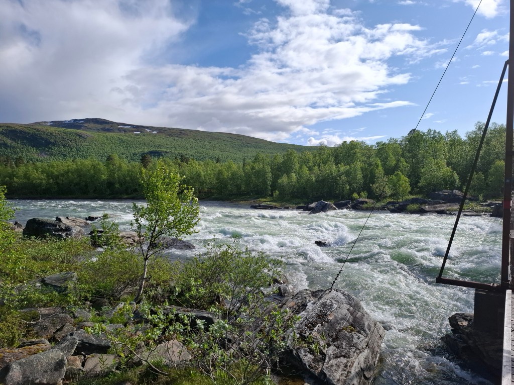
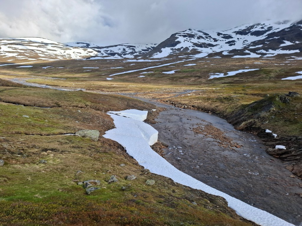
The next STF station we came to was Sälka. There we persuaded the wardens to open the shop for us to get some supplies. Continuing on we continued a long, slow descent from the heights. Eventually we came to a huge delta with lots of fast flowing and inundated rivers and streams as well as widespread snow covering. This made for difficult terrain to traverse as there were no footbridges. Sometimes the snow covered the water forming bridges. On one occasion I ended up fording a river at the widest point in about half metre deep water. Technique is to ford diagonally against the current with your rucksack straps loosened in case you fall. Cammie opted for the more agile jumping of the river and kept his feet dry! At another point where we needed to cross Cammie decided to use a snow bridge. I, with probably misplaced fear, declined and sought another means to ford the river on foot further downstream. The snow bridge I had seen being used by a herd of reindeer so am sure it would have taken my weight. To be honest I was glad to get past that rather fraught landscape.
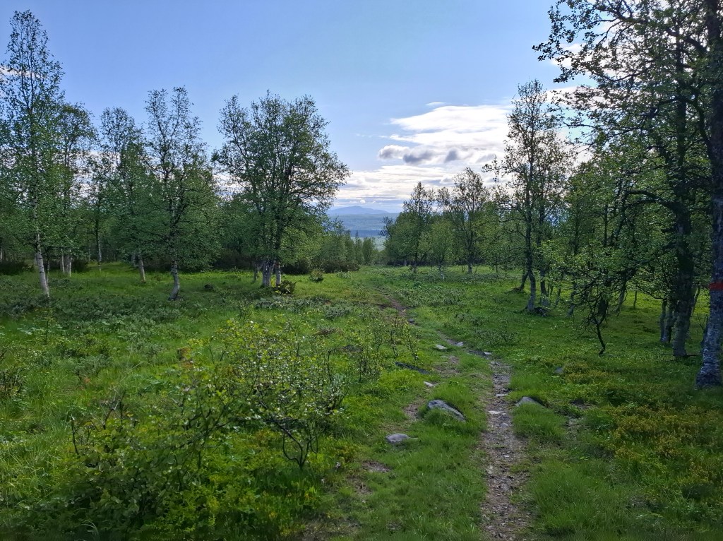
As the day wore on Cammie moved further ahead. Leaving the deep snow the trail now entered birch forest. We were concerned that arrival at Teusajaure, our destination for the day, was going to be very late. Each STF hut has certain times that the wardens operate. I arrived at Kaitumjaure, the penultimate stage for the day. The warden there said Cammie had been through and she had informed Teusajaure of our late arrival. I reached Teusajaure at 2300 to be greeted with notices welcoming me and to help myself to lingonberry juice and chocolate on the porch. A sleepy warden appeared and reprimanded me for being so late for which I could only apologise. At the same time she was very kind and hospitable, and concerned for me. She said we shouldn’t be contemplating such distances each day and must rest.
Needless to say we did not take her advice and were off as planned the next morning. The wardens do a fantastic job the whole summer. For their services they get a small renumeration and have to tough it out in often difficult circumstances. They do it out of love for the great outdoors and to help others enjoy it.
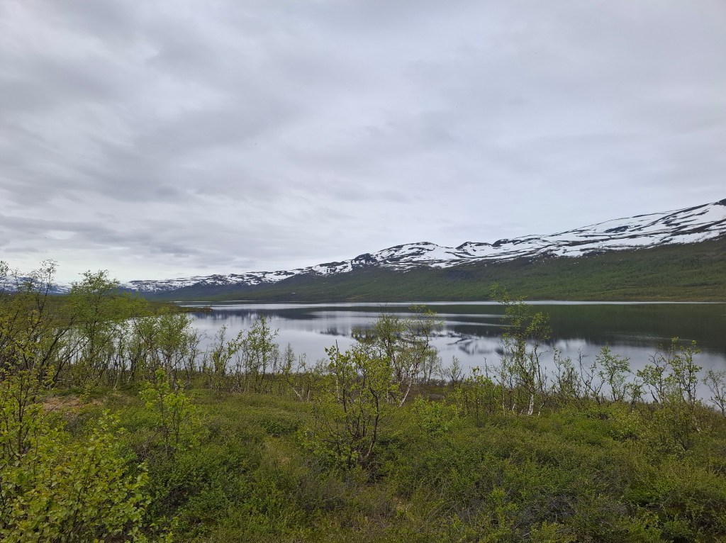
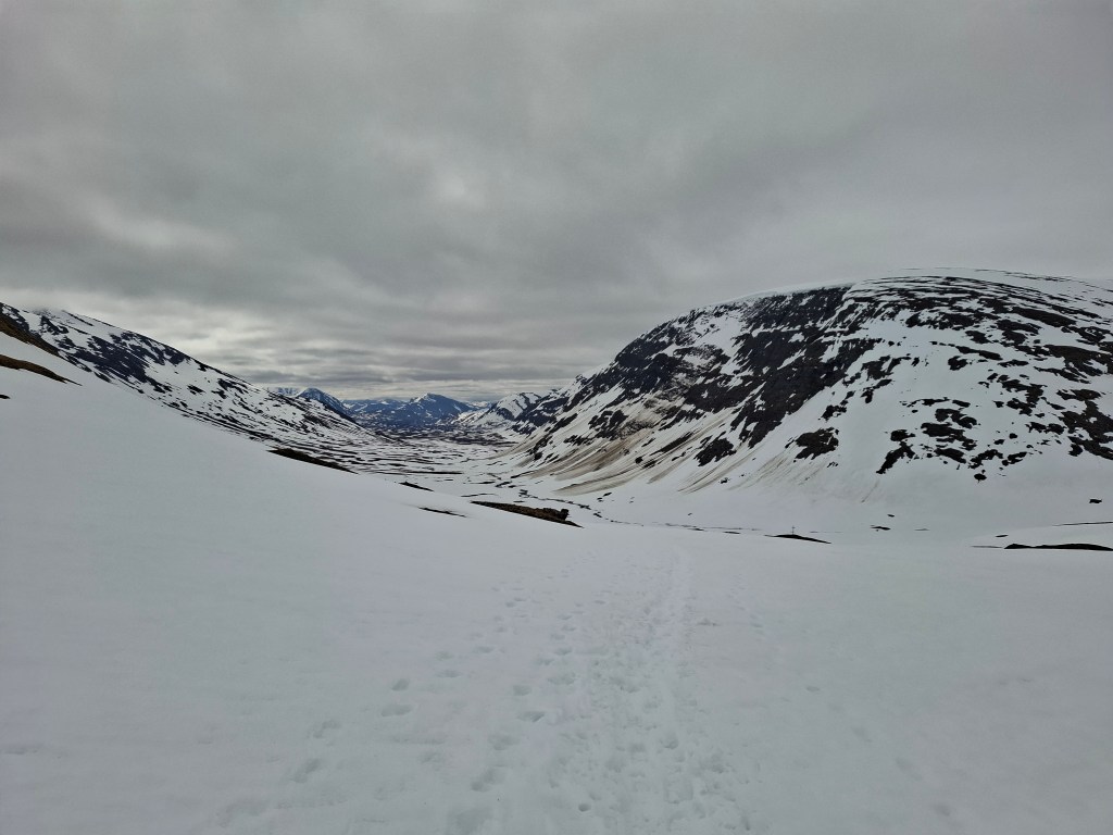
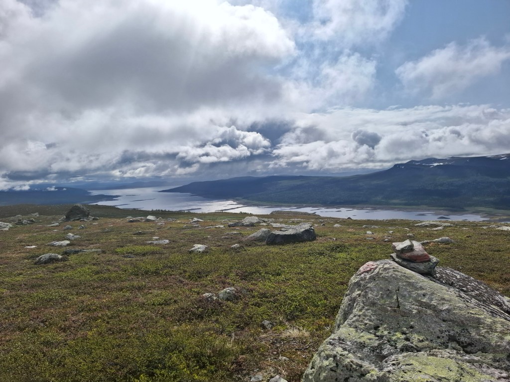
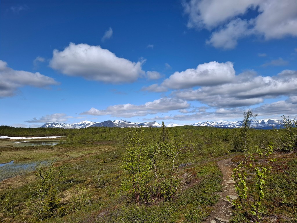
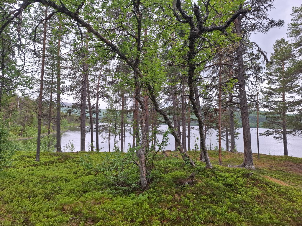
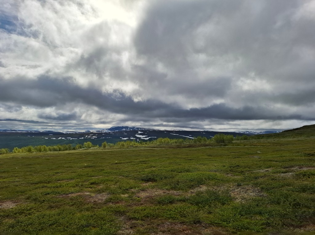
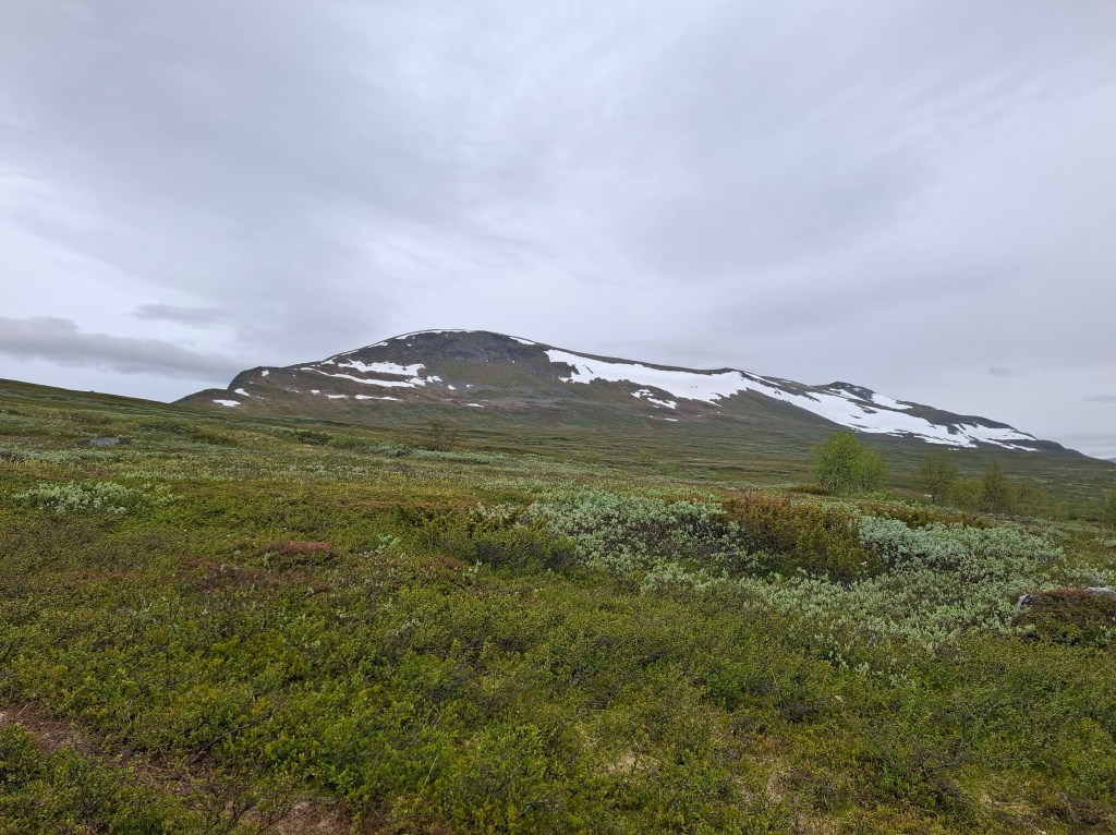
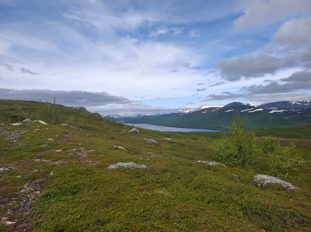
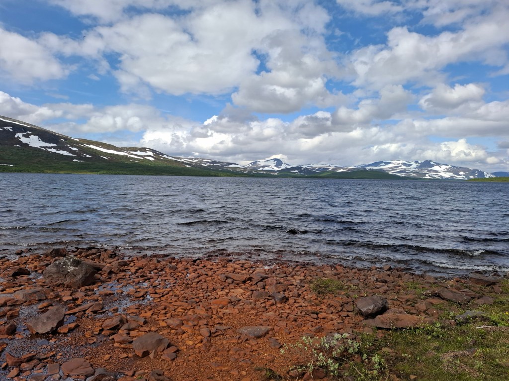
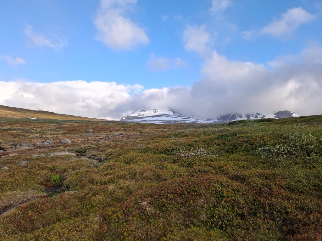
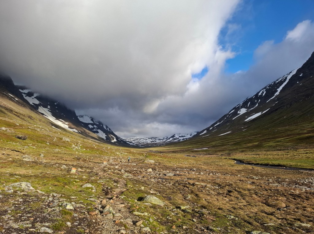
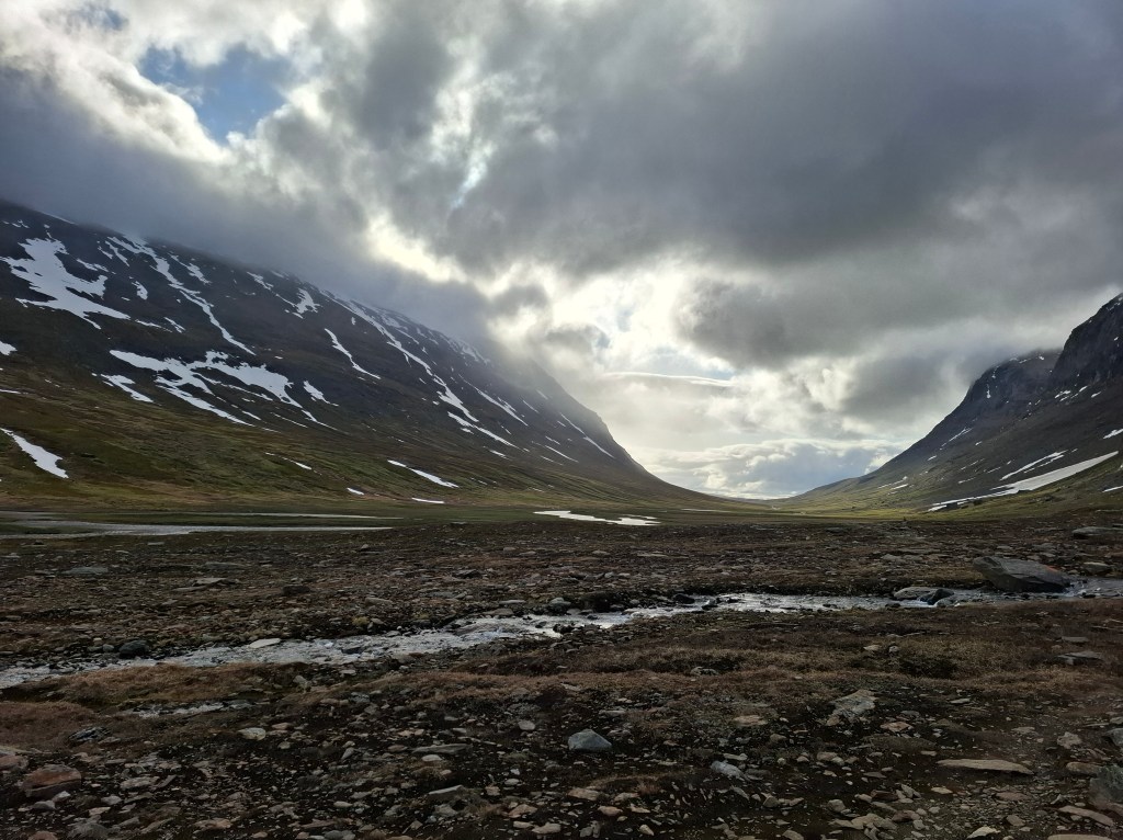
The snow covered mountains surrounded our meanderings through endlessly long valleys. They were mainly black and white, monochrome. The white snow contrasting with the blackness of the exposed mountainsides. They were not inviting, indeed they had more a sense of foreboding. A place where people and, in general, living things do not linger. There was a bleakness to it, but they were also witness to a stark beauty.

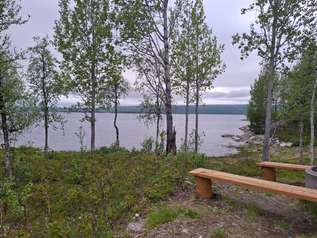
DAY 3 Monday 23rd June 14.37 km. Teusajaure – Saltoluokta

Today would be different. Two water crossings, a bus ride and a much shorter hike! Our day started with a short walk to the first of the 7 mandatory crossings. These crossings had been a concern to me as they usually entail booking ahead and making sure you arrived on time. However, they also provided a welcome break and change of scenery on lakeside. Our crossing today was followed by a leisurely hike which was in sharp contrast to our first 2 days. We only had to connect with the bus at 1450. Even had time to stop and make a brew on our micro stoves. Also managed to get phone reception which we had not had previously so some contact with outside world.
Whilst waiting for the bus at the STF hut at Vakkotavarre we had the opportunity to meet a few fellow travellers. Also chatted with the STF warden. Turned out he was a retired teacher of Swedish. He gave me some unasked for grammar lessons! He quite accurately reckoned that most Swedes would be too polite to correct me.
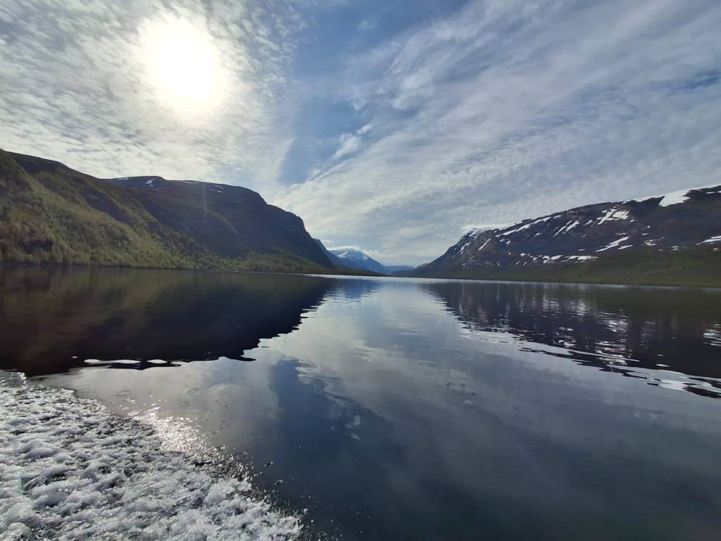
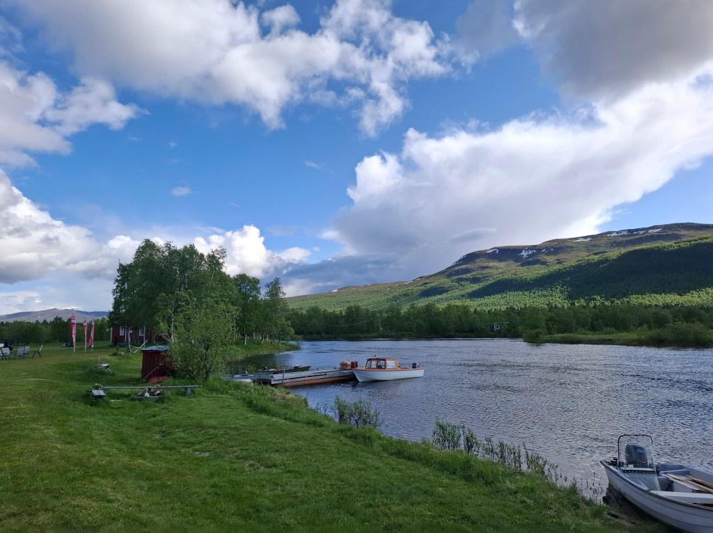
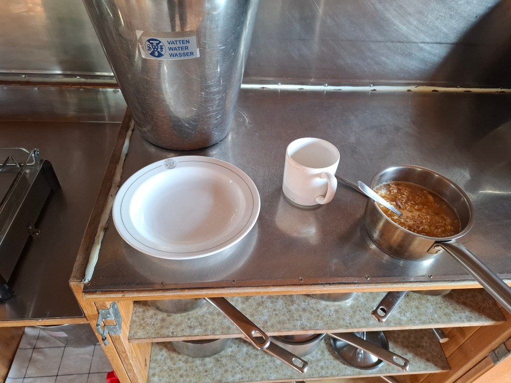
The handful of us that were getting the bus were careful to be at the roadside in plenty of time. It was a 30 km ride to next ferry point but halfway along it stopped at a guest house cum hotel. A 25 minute stop afforded the luxury of a cold drink and ice cream in warm sunshine. Then on to Kebnats to get the ferry over to Saltoluokta. Here we stayed at the STF fell station where there was running water and electricity. Fell stations are bigger than the huts and have more facilities. The place had a summer alpine feel to it. A great end to what was a much lighter day physically. Even had a shower and washed some clothes, using the drying room. Also used the kitchen and was quite taken with my concoction of noodles and a tin of tuna. Beat the dehydrated meals for taste.


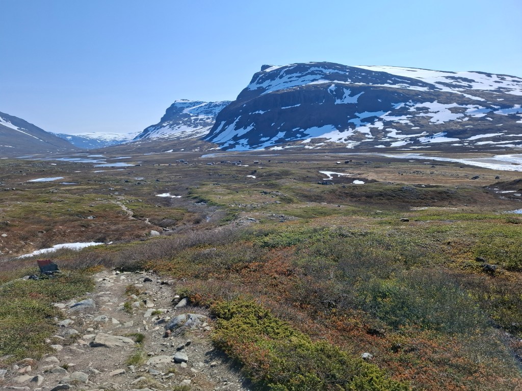
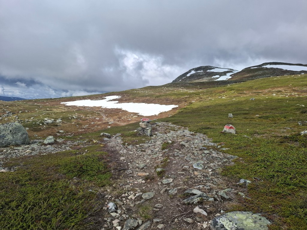
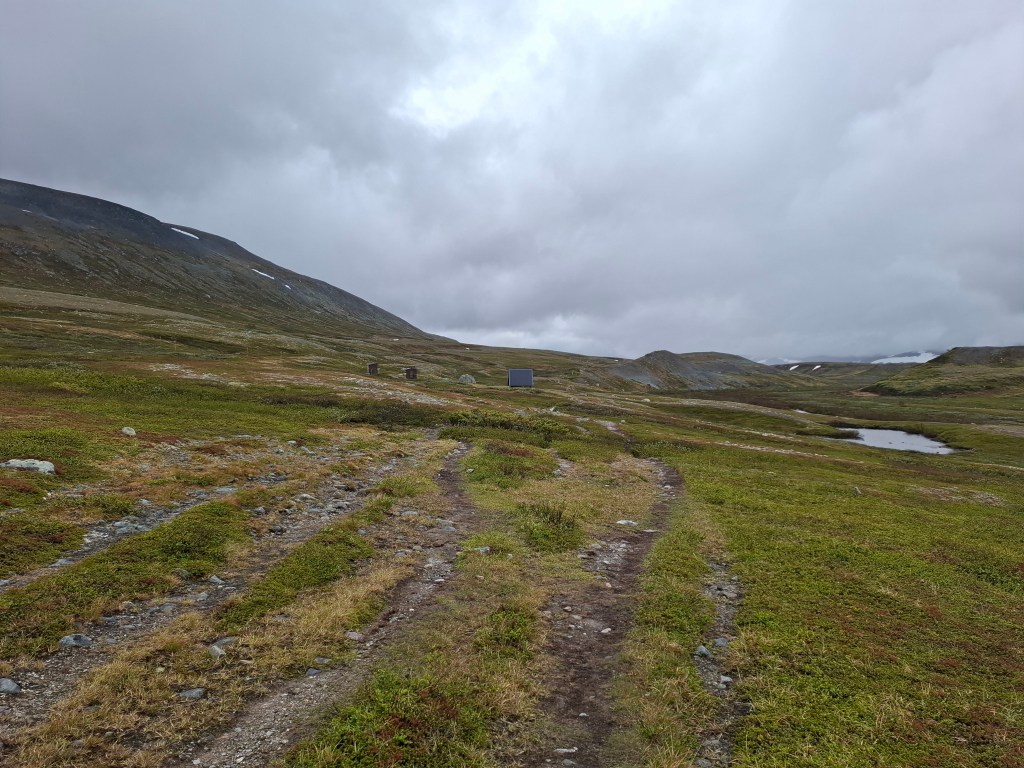
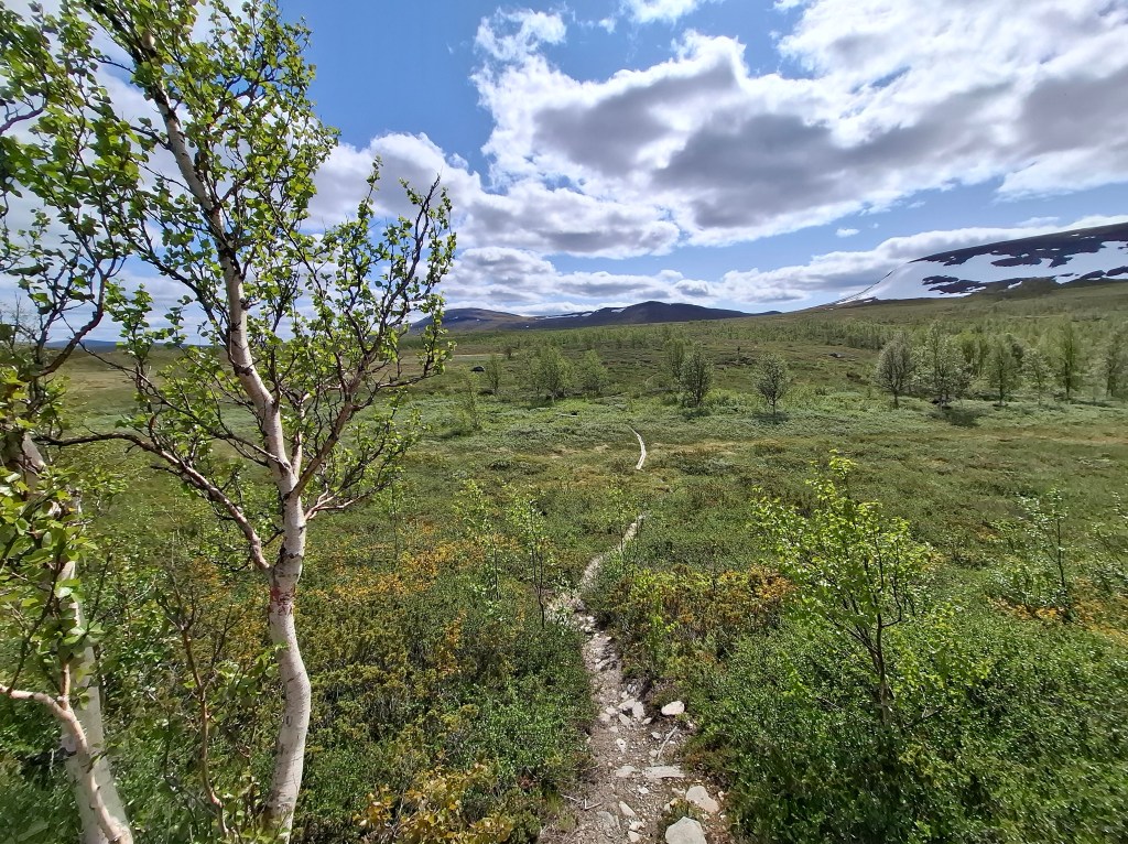
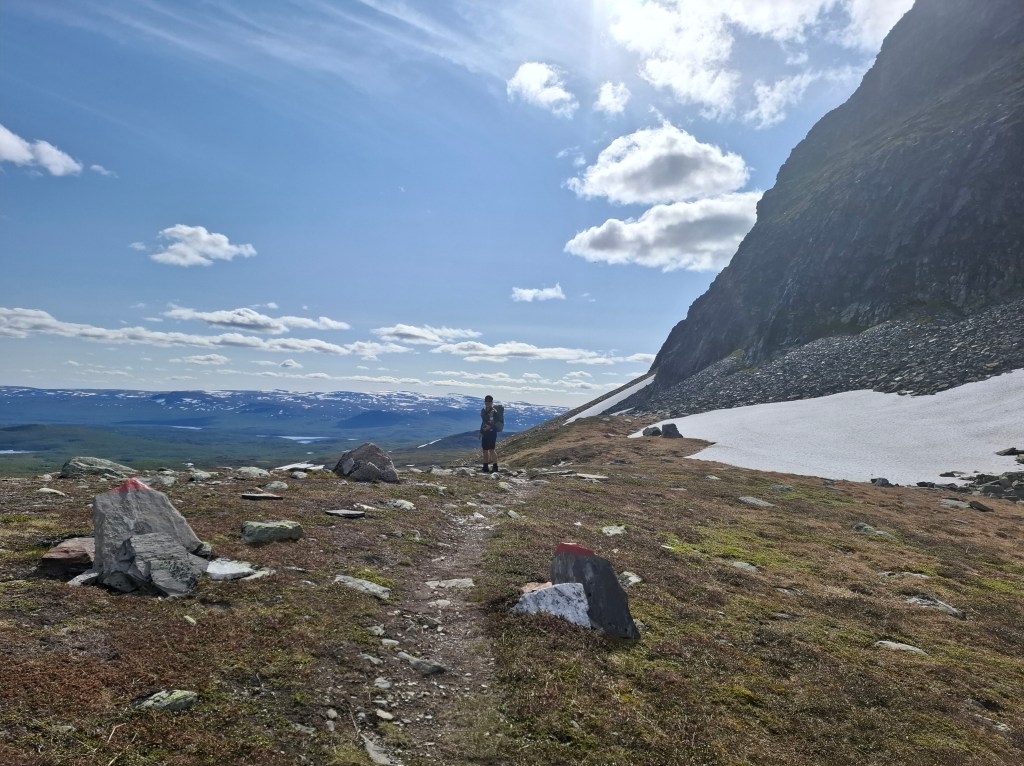
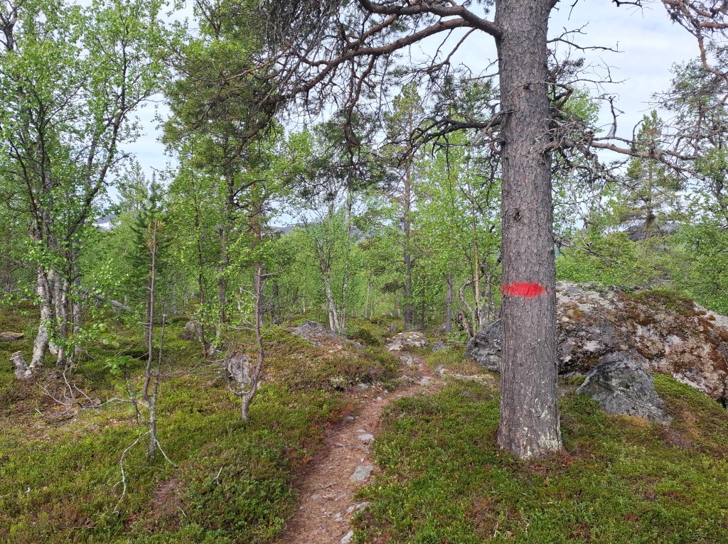
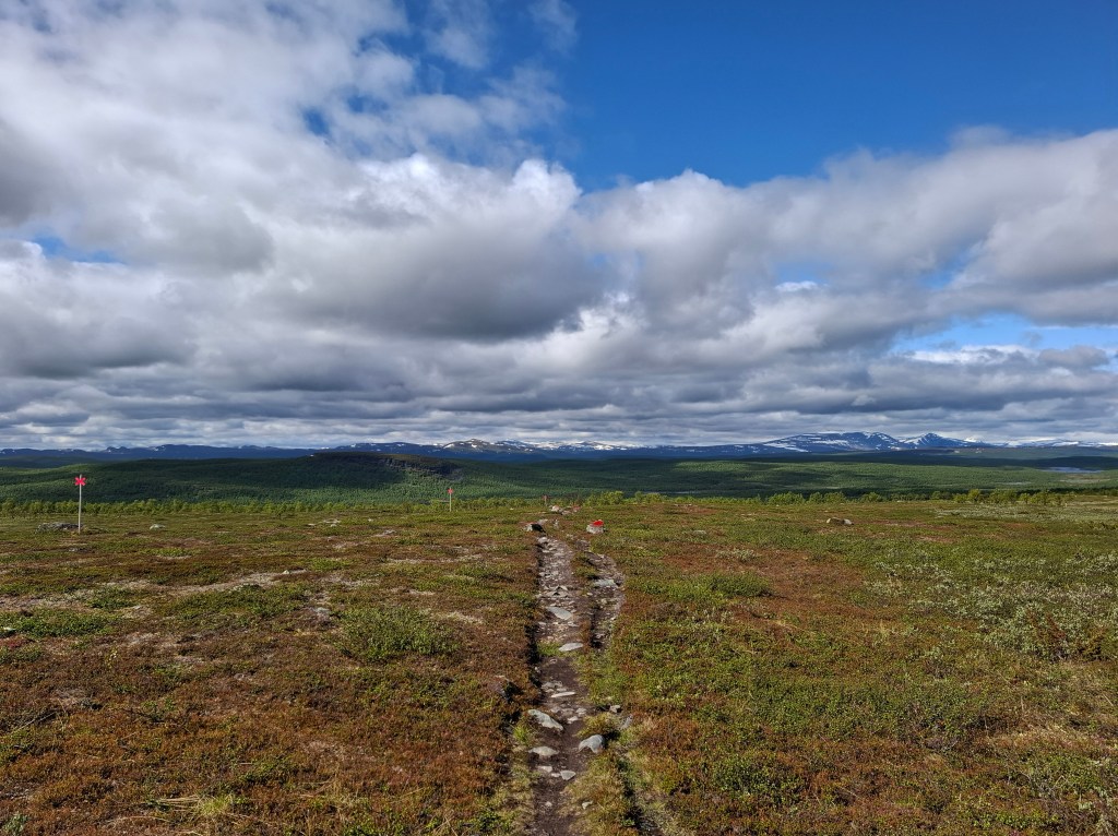
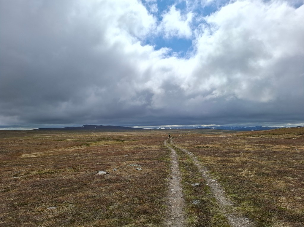
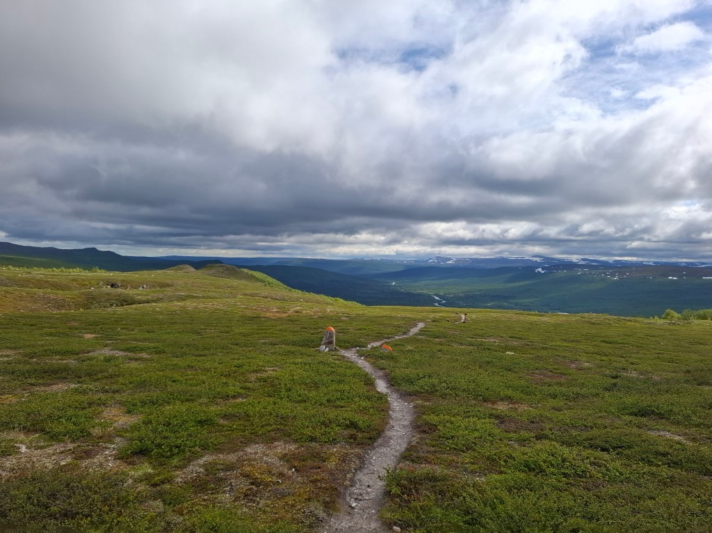
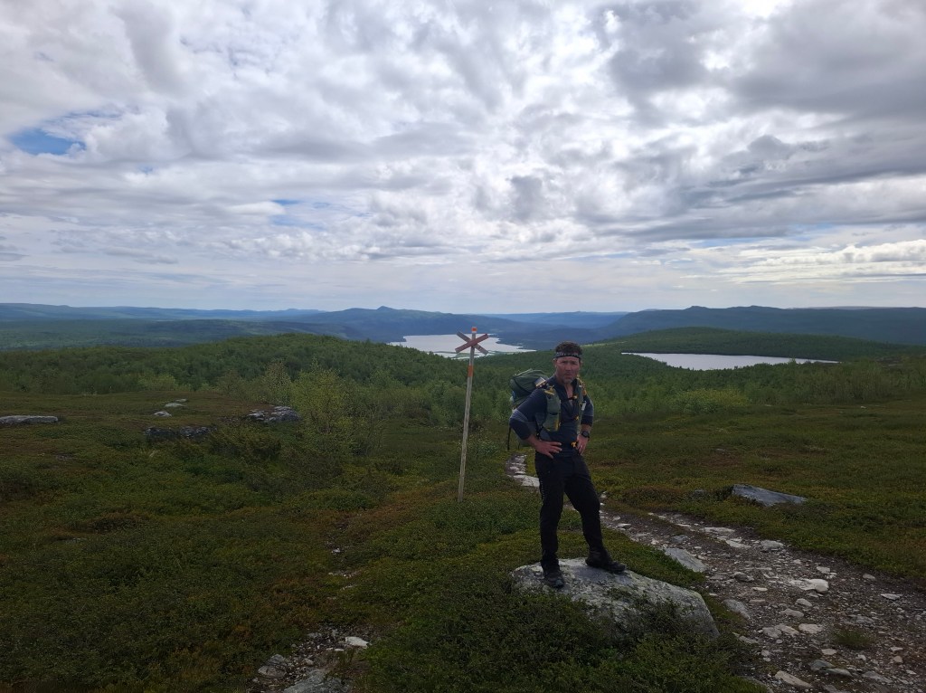
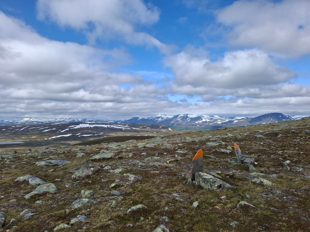
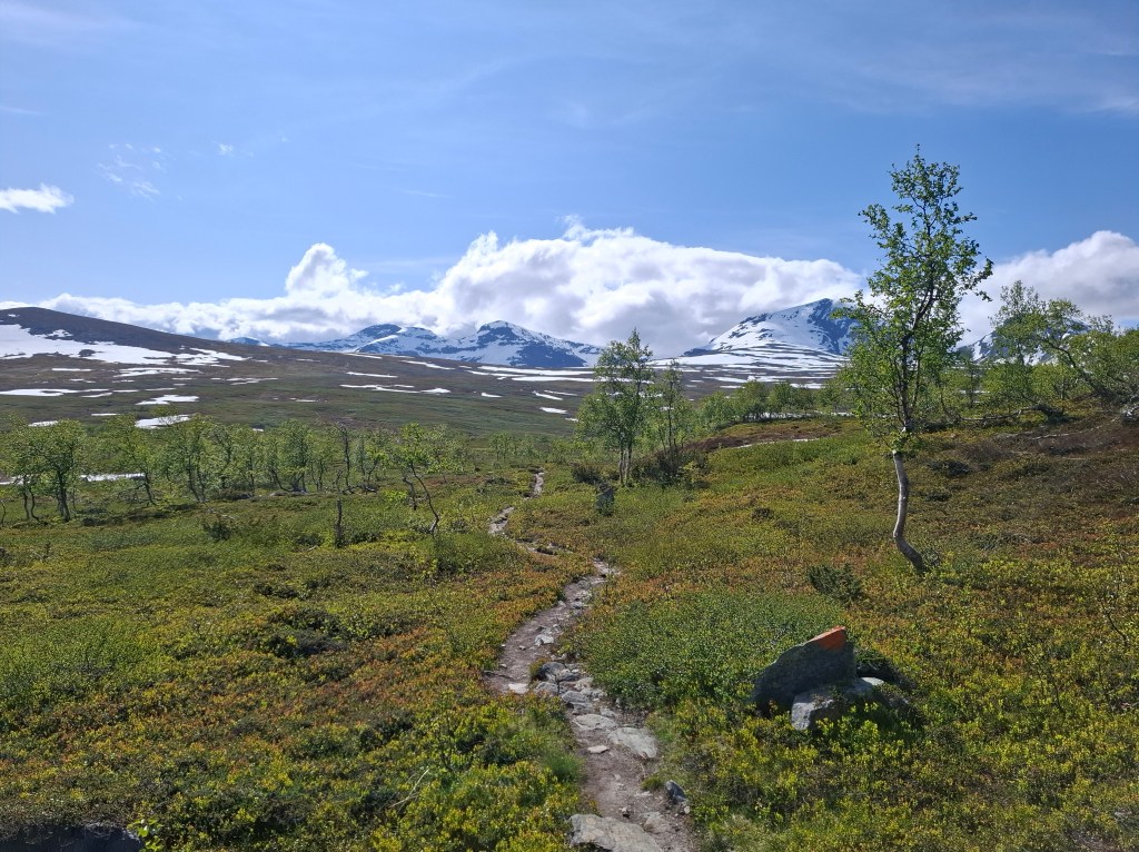
Countless waymarks show the way along KL. Usually red, though in the south they turned to orange. Painted on rocks on both sides of the way in the big, open sky landscapes. On tree trunks in the forests. They gave constant assurance that you were on the right path. More than once I found the open expanses unnerving, as if I was too small for this environment. The markings were like sentinels, guarding the way. Every time I saw a marker it gave peace. Thankful for those who have laboured to cover such a vast area with these reassurances. The winter markers are red crosses on poles. Care is needed not to follow them. They are routes for snow scooters and for skiing. They quite often cross frozen lakes in the winter which means if you follow them you end up on a lakeside with nowhere to go.
DAY 4 Tuesday 24th June 29.78 km. Saltoluokta – Aktse
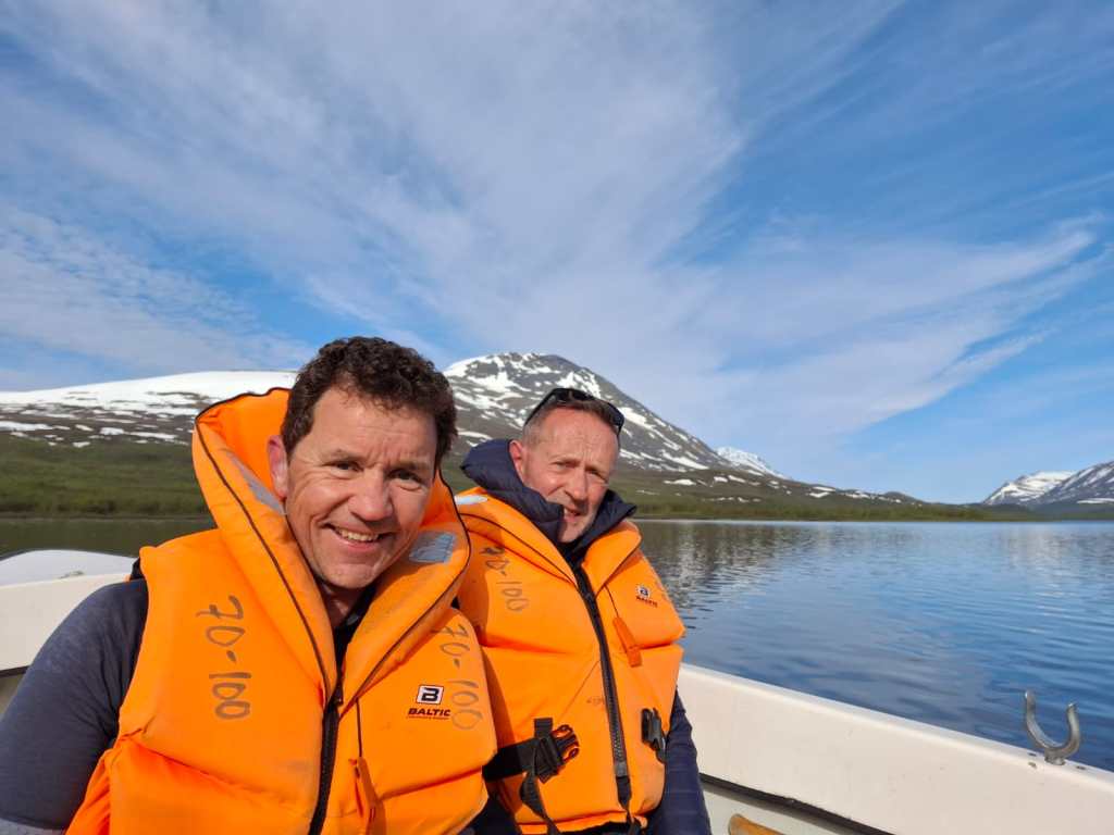
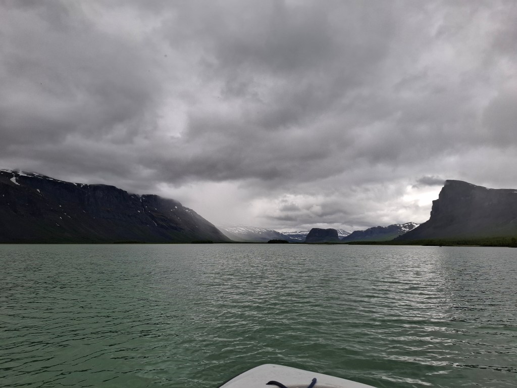
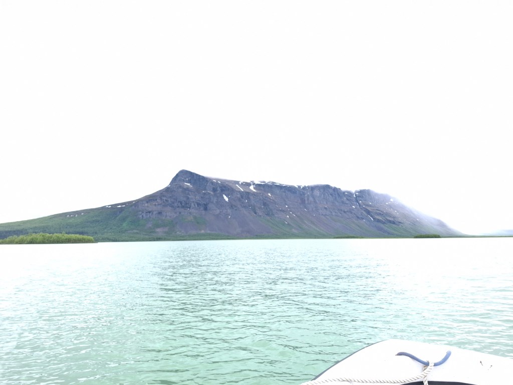
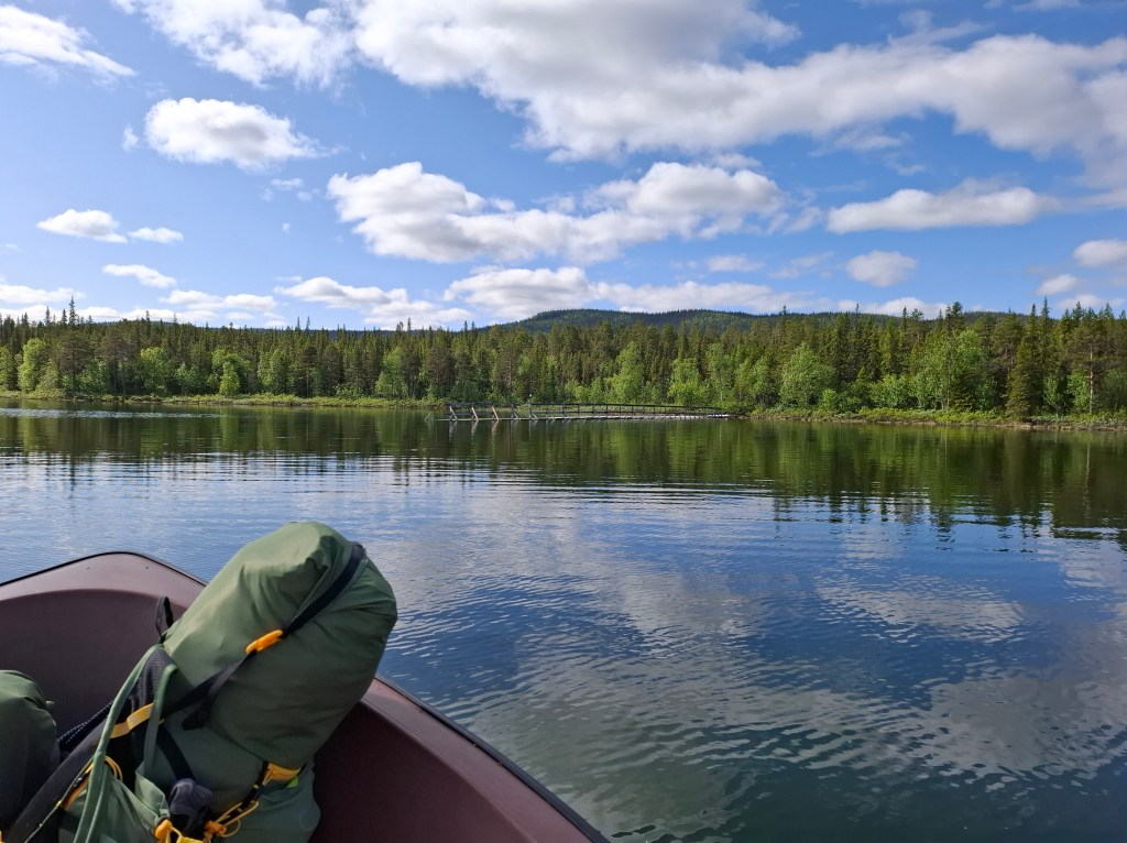
After a full buffet breakfast we also took the pack lunch option, always good value. They allow you to take what you wish from the buffet. As we often didn’t know when we would next eat apart from dehydrated meals we made good use of this. Leaving, we now headed for Sitojaure, 19km away, and where our next lake crossing was. At an emergency hut 9km before Sitojaure we had phone coverage and called ahead to book an early ferry. Only managed to leave a message. We got to Sitojaure at 1315. The ferry was privately managed by a Sami family. After a bite to eat and drink from our supplies we got the 1400 ferry. The lady suggested that if we hurry on the other side we could catch the 1700 STF boat run from Aktse. This was a great tip as meant we could have an early start next morning and no need to wait for ferry.
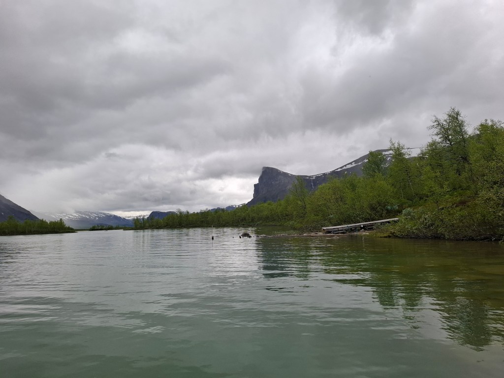
We did indeed catch the Aktse boat and also bought a few things from the STF hut shop. Many of the huts have small shops with dried and tinned foods, drinks etc. These were indispensable if we were to keep moving! The ferryman was an enthusiast for the area. When I said he was living in a lovely place he said he was jealous of us passing through. We were on the boundary of Sarek national park and he was insistent that we should get some good pics with Skierff in the background as we crossed the lake.
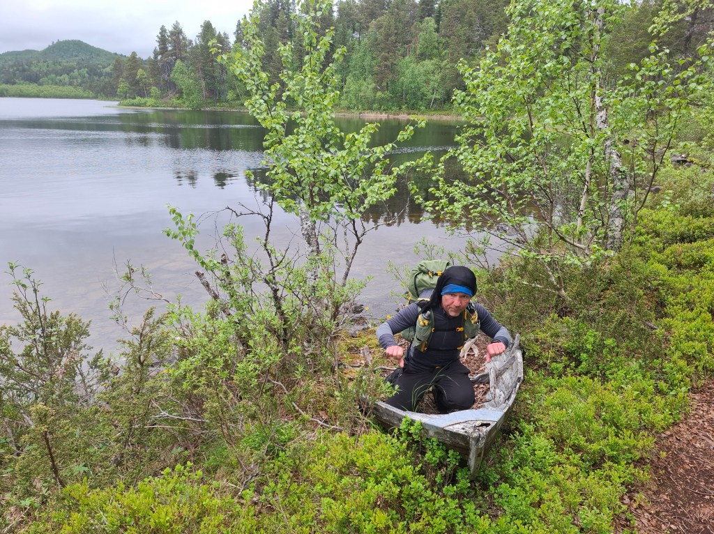
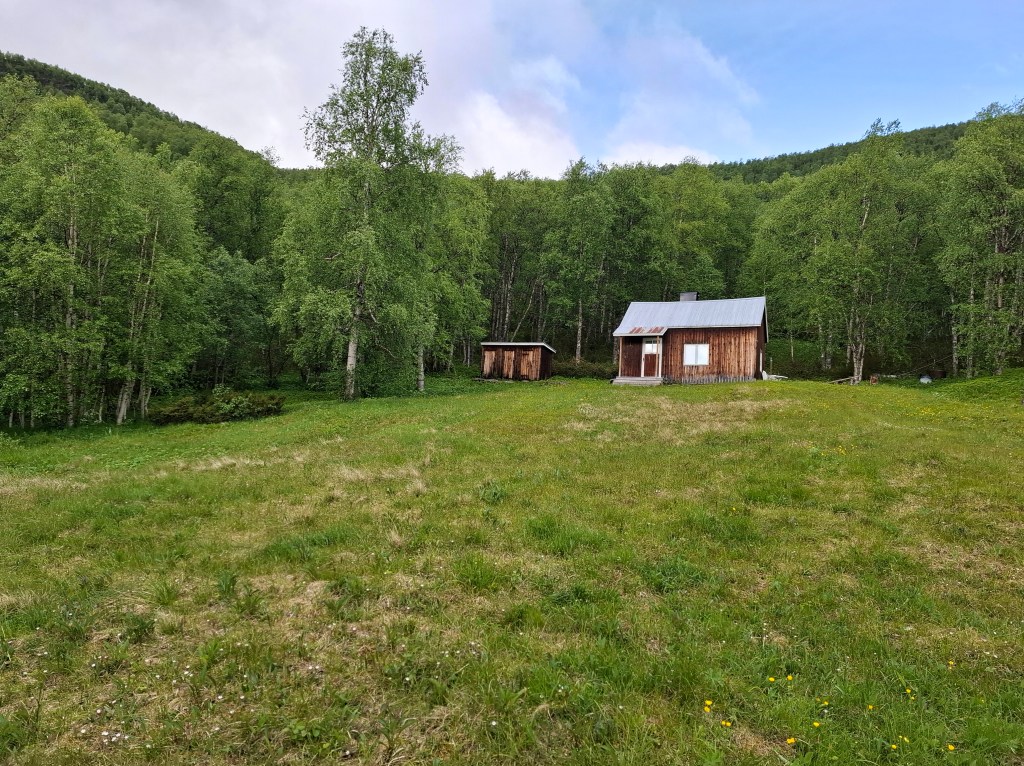
Once across we set up tents but ended up sleeping and eating in a bothy type hut nearby. Was a bit disconcerted by most of the sheds seemingly attacked by some animal.

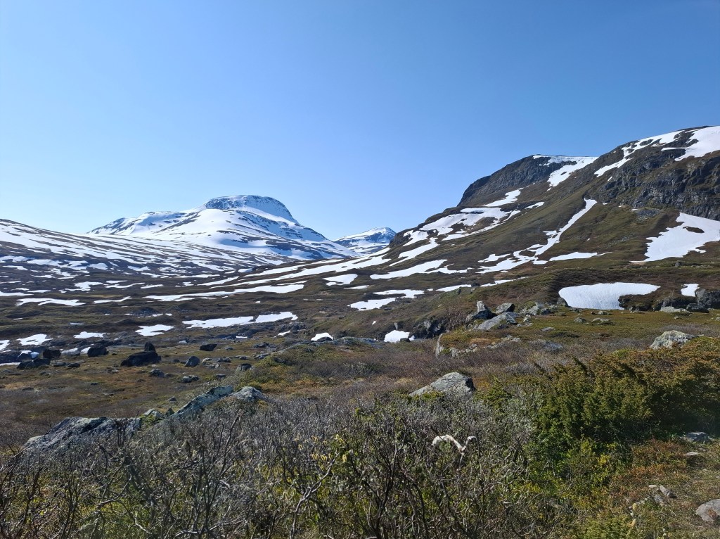
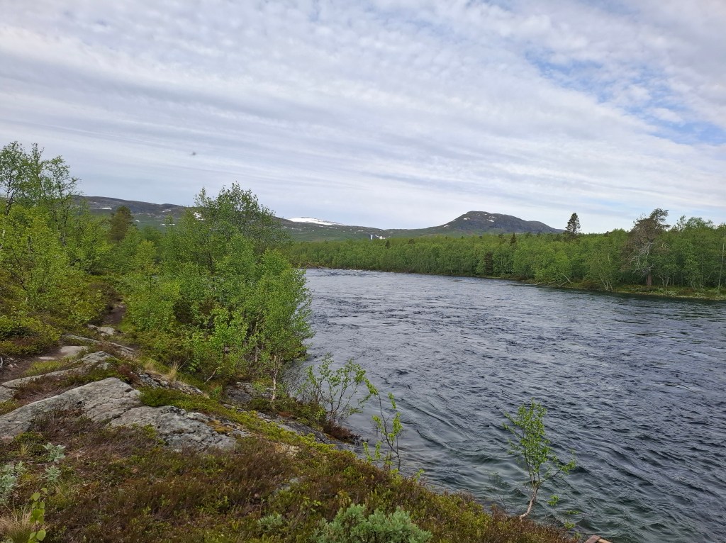
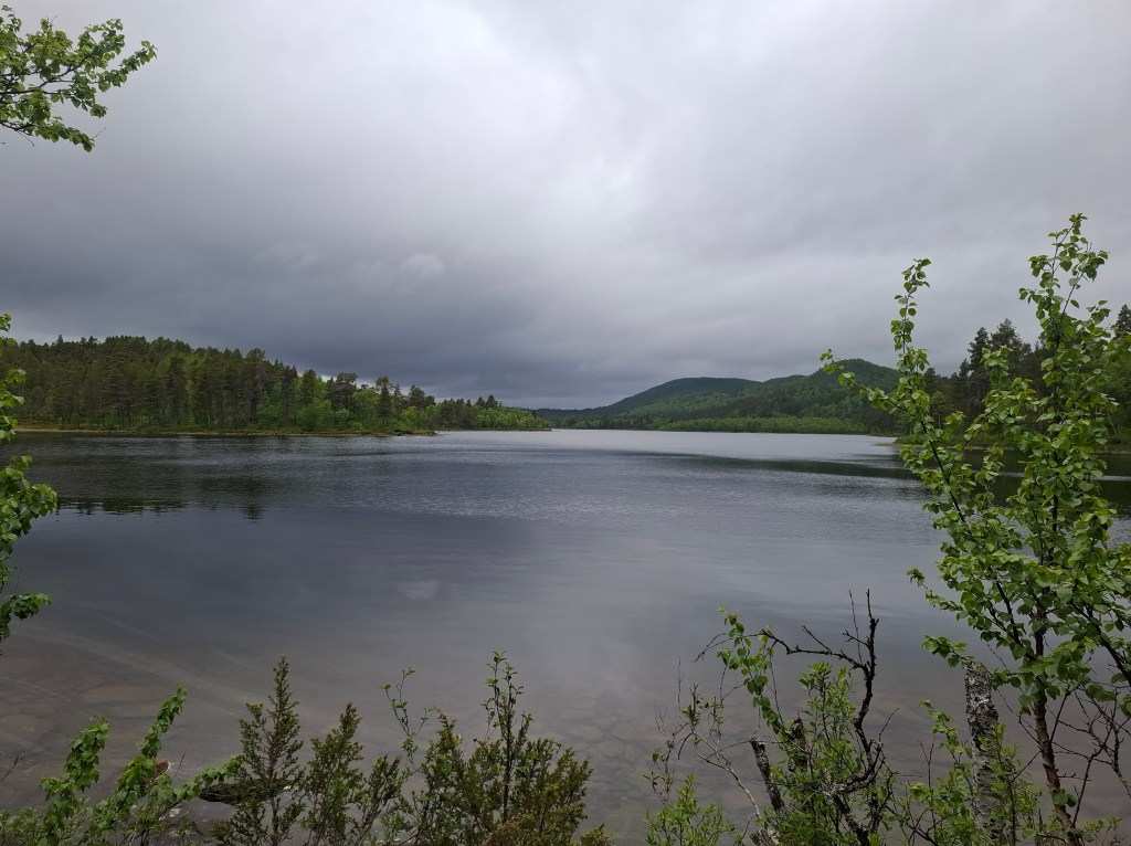
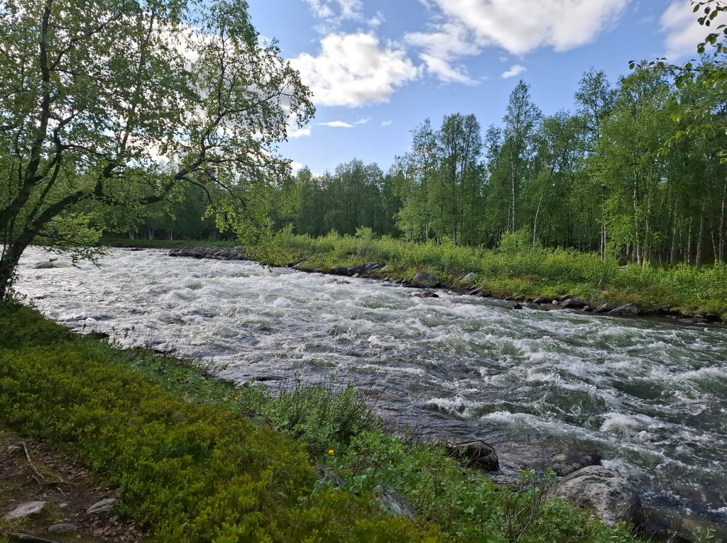
The rivers are grown up rivers. Powerful and always roaring. They almost seem angry and definitely in a hurry. Commanding respect and caution. The amount of snow melt is huge. There may also be glacial melt but I don’t know. It seems every tributary and stream is trying desperately to shed this huge volume of water. In the north the water had a greenish tone. This changed to a more steel grey in the southern regions where there was less snow. Crossing the many footbridges was humbling in the presence of so much raw power.
DAY 5 Wednesday 25th June 36.80 km. Aktse – Kvikkjokk
After a steady hike we came to Kvikkjokk STF Fell Station where we had booked bed and breakfast for the night. Again there were excellent facilities which enabled us to wash and dry clothes. Finished the day with a meal of reindeer meat. It was a nice oasis of comfort.


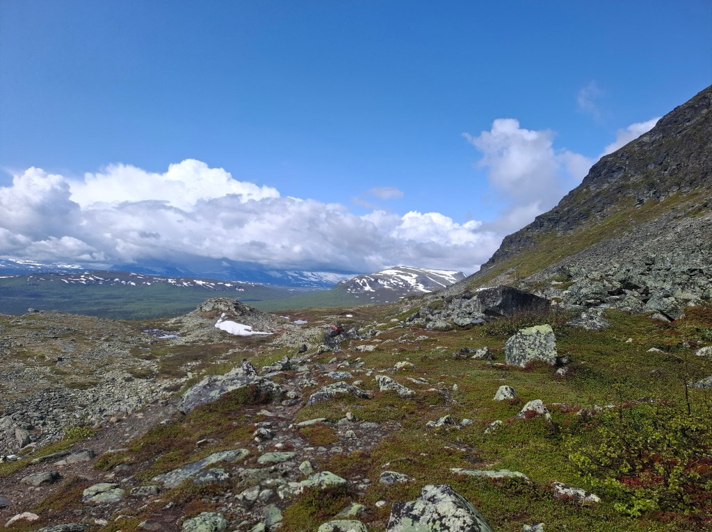
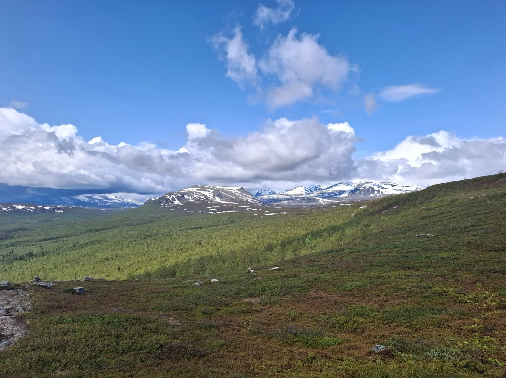

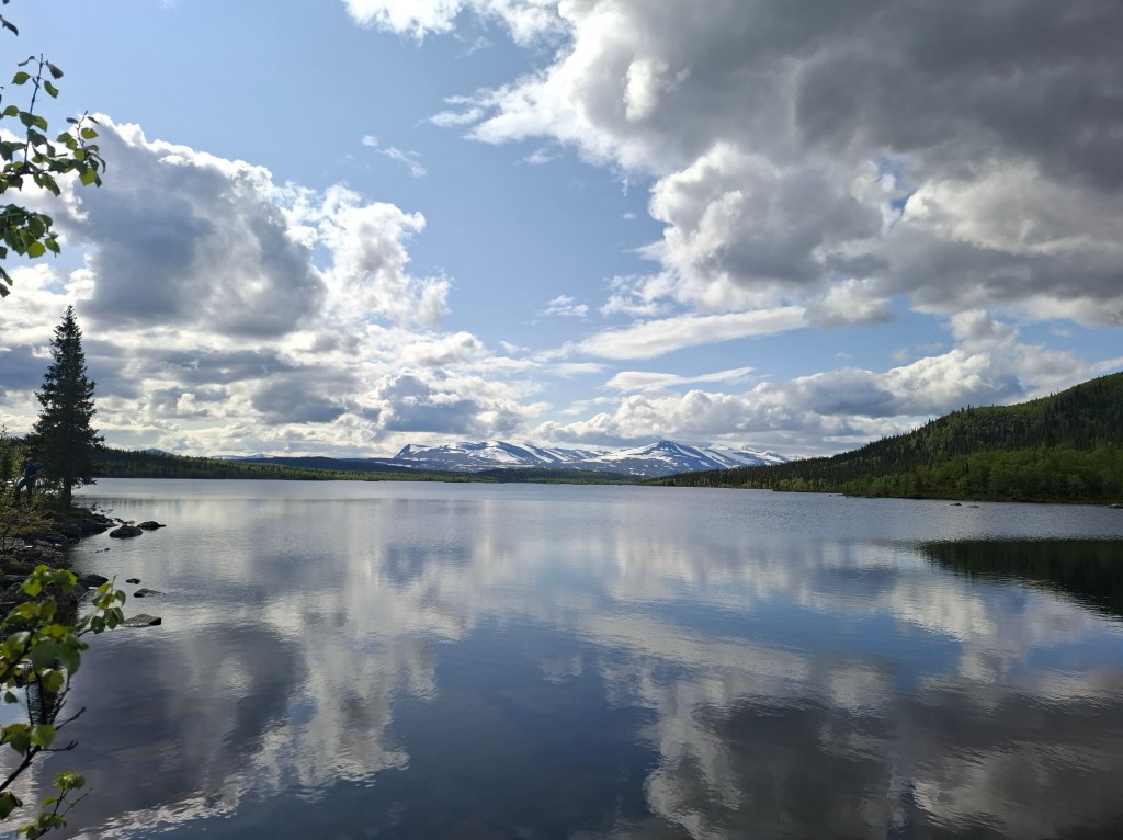
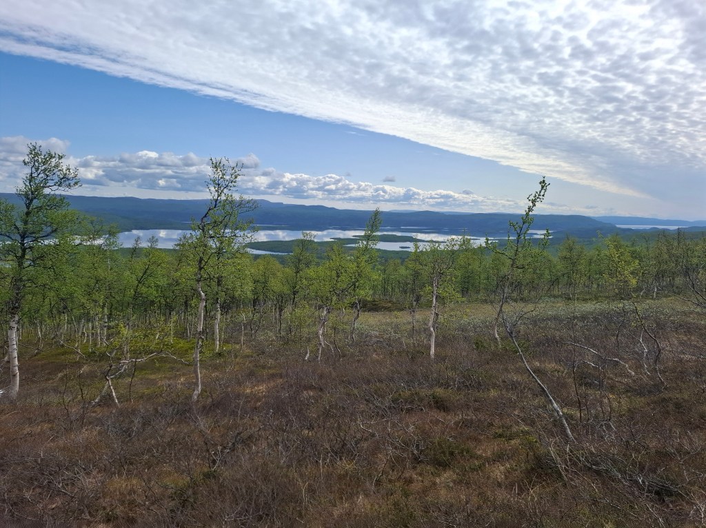
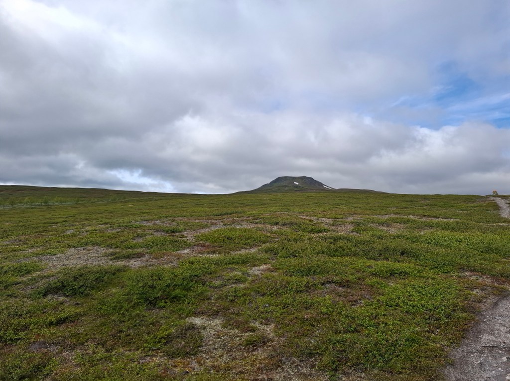
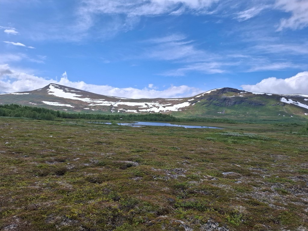
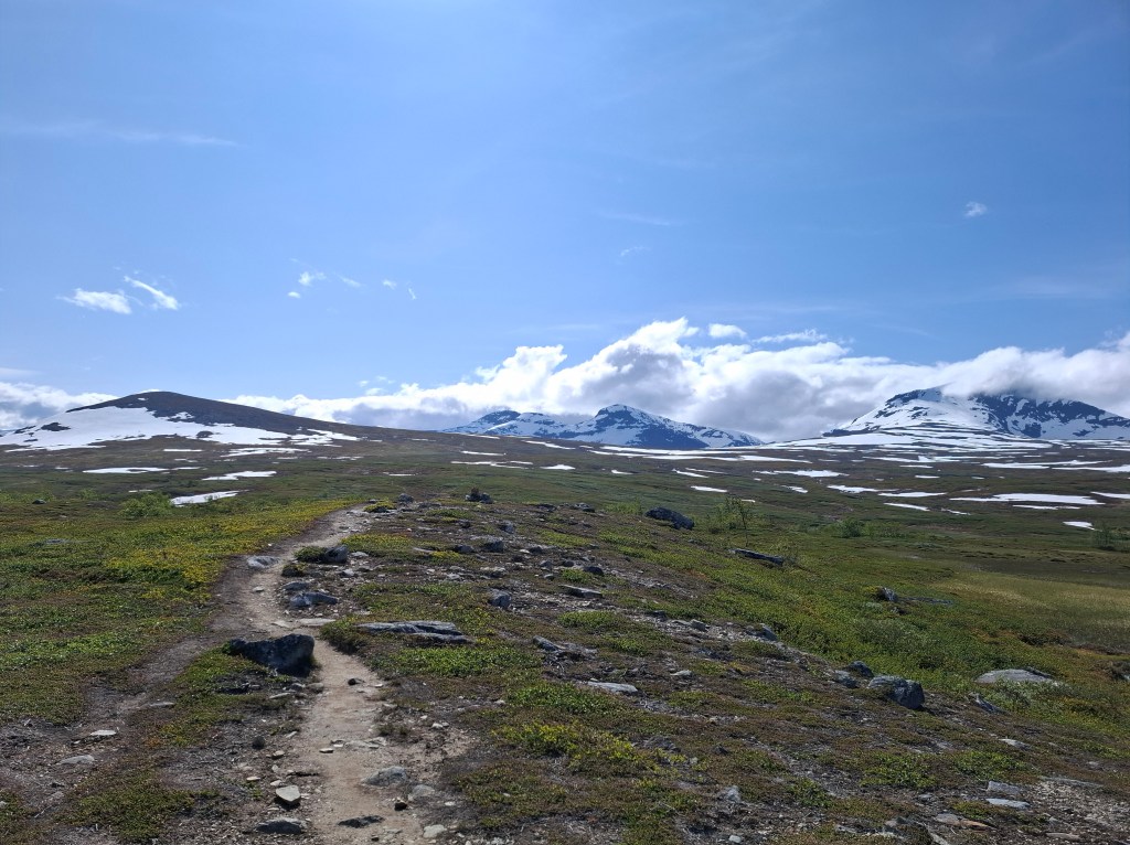
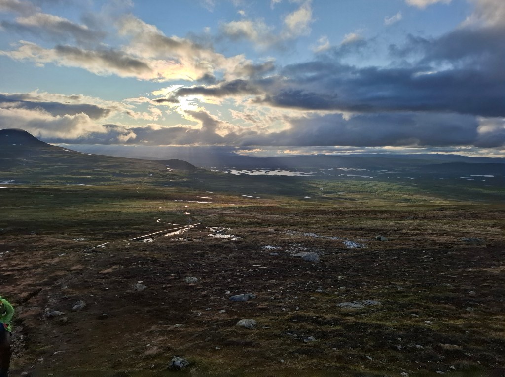
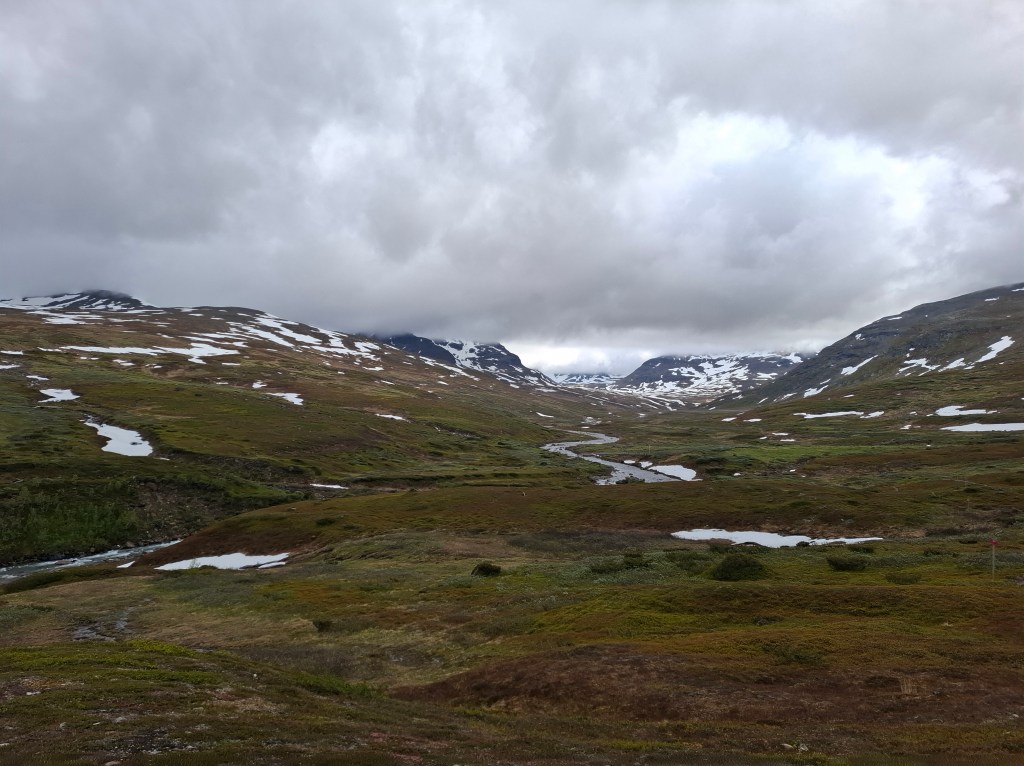
The landscapes were ever changing. One minute it felt like deep winter. The next it was what you expect midsummer to be. The moment a cloud covered the sun a chill wind would usually roll through. Large and frequent temperature changes. The environment would play on your mood. The big skies meant that sometimes you could see 2 or 3 skies at once. Great trails of high altitude clouds in one direction, misty landscapes in another direction and bright sunshine reflecting off the mountains.
DAY 6 Thursday 26th June 35.58 km. Kvikkjokk – Gistojavratj

As on other occasions we enhanced the buffet breakfast by supplementing it with the pack lunch option. Food was on our mind as the next 2 days it seemed there were no places to pick up food. Our day’s journey started with yet another boat crossing. Our ferryman was excited to show us the sites on the way. This included beaver lodges by the waterside as well as close up views of the surging waterways. There was the novel experience of paying for our ride by meeting another boat midstream when our cards were duly swiped.
After the boat ride we started out at 1010. It was a long day and we made camp on the shores of Lake Gistojavratj about 1900. There was a hut in which we ate our meal but as is the custom you are expected to camp outside. Emergency huts are only meant to be slept in in an emergency. By all means get some shelter and eat some food but sleep outside. It was not a particularly pleasant night as the mosquitoes were especially active.


Apart from one memorable group of 3 Germans the majority of fellow hikers we met were solo. Of those planning to do the whole trail they had an unplanned time to do it. Most were thinking 3, 4 or more weeks and appeared to relish being mostly cut off from outside world. Conversations round the dinner table in huts were free from distractions.
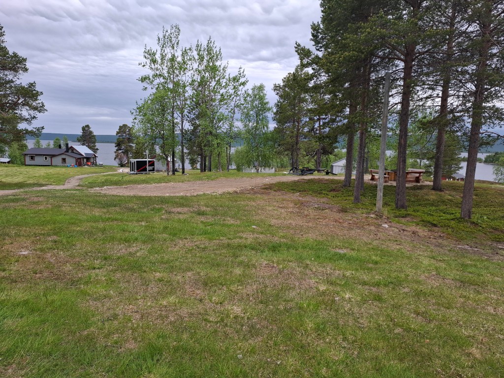
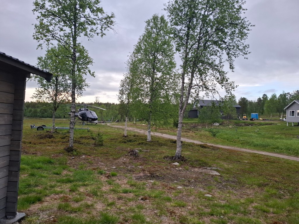
DAY 7 Friday 27th June 34.21 km. Gistojavratj – Vuonatjviken
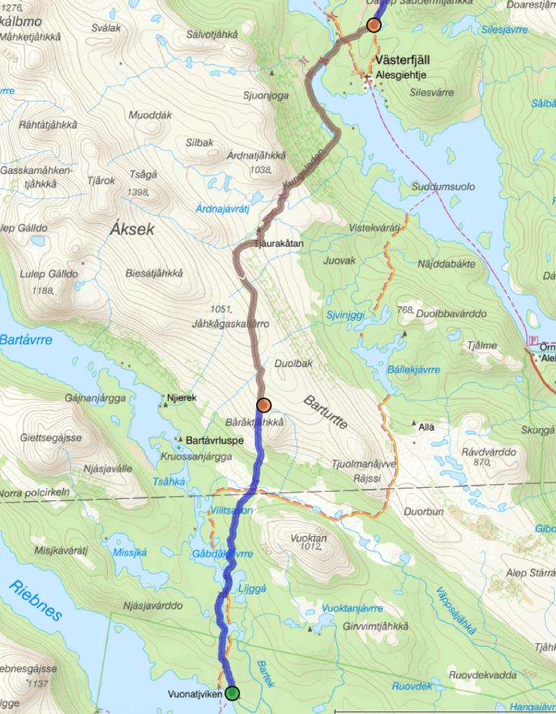
Today was a departure from plan. Rather than a short day we would press on to Vuonatjviken where the large and penultimate crossing was located. At some point we left the Arctic circle. I suppose I was expecting a sign on a tree or something but there wasn’t anything. Ended up taking a selfie where we thought it was.
At Vuonatjviken we would camp for the night and then get the 0900 ferry across Riebnes lake. At some point a few hours before our arrival we met a couple going north, in the other direction. They made the rather odd statement that if we got there before 1700 there would be pizza!? As we were well into the second day on our meagre rations from our rucksack this was music to our ears. Though hard to believe. It did provide enough incentive to up the pace a bit in case the 5pm deadline was true.
We made it on time and amongst the various outhouses there was a small caravan. Ringing a bell a woman came from the nearby house and we ordered the pizzas we (or I ) were dreaming of. Very enterprising to have this in the middle of nowhere. As if to emphasise both the business opportunities and its ‘hard to get to’ location within a few minutes a ‘fishing helicopter’ arrived. This was followed shortly after by a seaplane landing on the lake.
Anyhow our more modest ‘deal’ was to get a combined campsite ticket which included ferry, outside toilet, pitch for tent and a barbecue shelter.


Whenever the wind dropped there were invariably mosquitoes. In the north they seemed totally suicidal. They seemed to drop on your skin and within a fraction of a second you were bit. Drunk on your blood they barely moved thereafter. Further south they were more sedate.
DAY 8 Saturday 28th June 18.13 km. Vuonatjviken – Jäkkvikk
Today had a few memorable highlights. A shorter day as we had done longer than expected yesterday. The day’s two water crossings would also be the last. That meant the rest of KL had no ferry or boat complications. We started with the longest crossing, 6km. It didn’t take long in the high powered boat. Cammie remarked on how tough the Sami people looked. We were all wrapped up against the cold and wind and the boatman was just in a T shirt.
There then followed a mixture of forest and open fell. Now we were approaching our last and final crossing. A short one of only 400m it was the only one that was compulsory by row boat. The crossing had 3 STF row boats. However if there was only one boat on the side you arrived lakeside, it meant you had 3 trips back and forth. This was to ensure there was always at least one boat on either side. Just prior to arriving we met, of all people, an Englishman. He said he had had to row 3 times and that there were now 2 boats on our side. Great! As we arrived we were greeted with a great cheer from the women in the boat shown in photo below. They realised our presence meant only one crossing and not 3 for them.
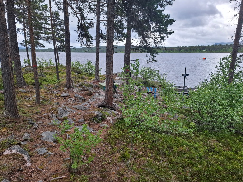
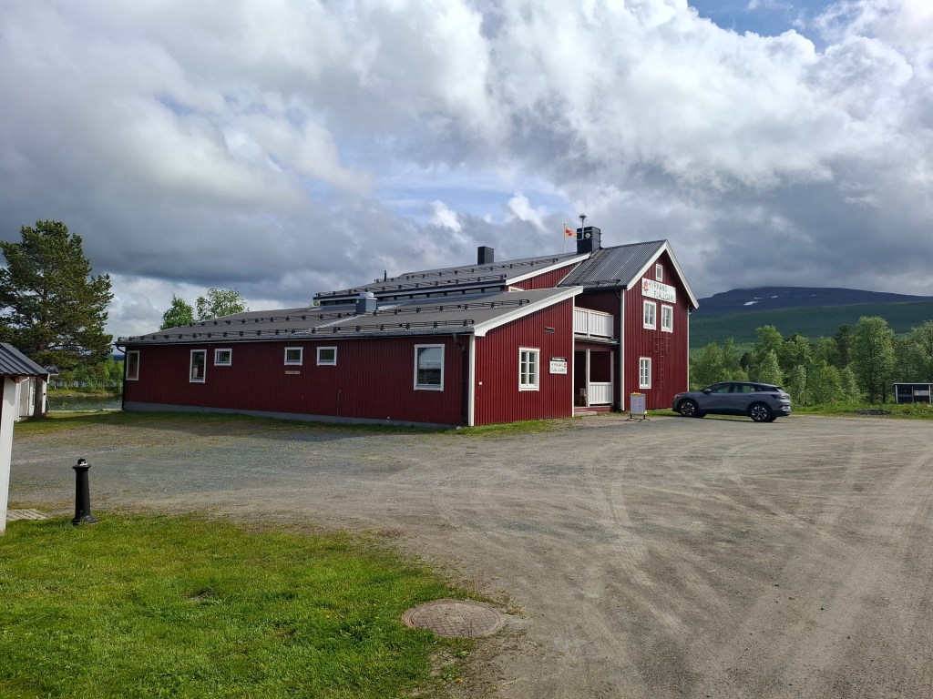
After our row it was only a few km before we reached Jäkkvikk, the next trailhead. Turning up on spec we got a bed for the night at Kyrkans Fjällstation. This was a church run hostel affiliated to STF. Refreshing to have a shower. There was a drying room so we had another frenzied washing and drying of our clothes. The hamlet only has a few dozen permanent residents but they have a supermarket which we made use of.


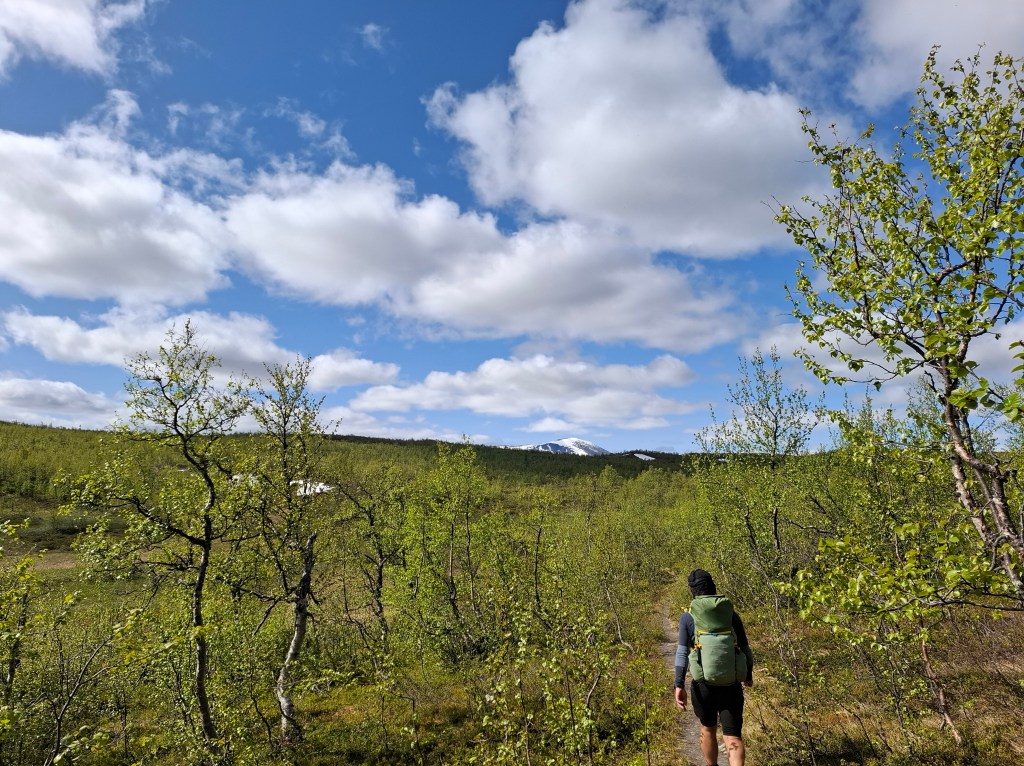
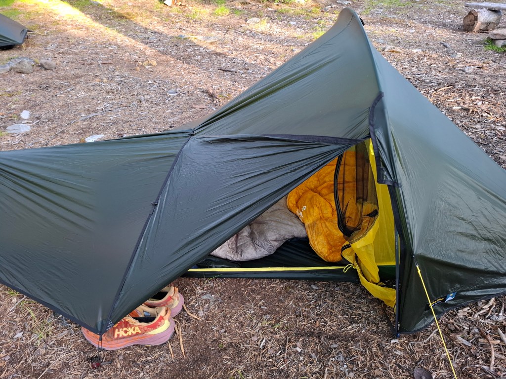
RUN OR FAST HIKE – We had deliberately kept our rucksack weight to 7.5 – 8kg and were wearing running shoes. This is as per previous multi day expeditions. On KL we did not meet anyone who was carrying under 15kg. Many bore a whopping 20-25kg, carrying everything but the kitchen sink. Were we safe? Cammie was always quoting the mantra that we always ‘pack our fears’. Meaning if you were afraid of hunger you packed 10kg of food. If you thought you would be sick you would take a medicine cabinet with you. I think given the fact of frequent, well equipped emergency shelters, huts and stations it is not necessary to pack for every contingency. This plus the sheer goodwill of all we met on the trail meant we were fine. What were the pluses with our strategy? Being light meant we were nimble. Our speed was at least twice that of those carrying big loads. Prone to less back issues or pressure on the soles of your feet. Were we running or fast hiking? I hardly ran at all, especially after the first day. The bigger issue in my mind was were we covering the distance required for our completing the trail in 2 weeks? In reality in a multi day scenario a high speed hike is probably more energy efficient than constantly trying to break into a run. Besides, we wanted to also appreciate the places your legs take you. I do not decry those with heavy loads, they were enjoying the experience just as much as us and probably had a few more camping comforts than us.
DAY 9 Sunday 29th June 33.22 km. Jäkkvikk – Bäverholmen

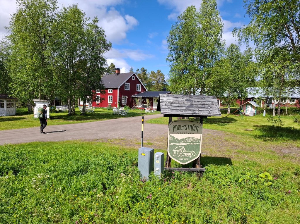
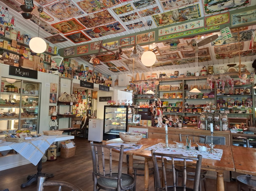
We were now seeing more signs of civilisation. On this stretch we passed through another small township, Adolfsström. There we found a cafe for lunch which also stocked a huge variety of other things. I even managed to get a mosquito net which I’d lost.
On into the afternoon we entered a large clearing at Bäverholmen. There was a Värdshus (a type of guesthouse) with a few rucksacks outside so looked promising for a mid-afternoon snack. On entering there was a couple eating and a child busy on a tablet. Cammie remarked it was a bit like an old western frontier town. The cowboy comes into a saloon and all heads turn to the stranger, an air of menace in the air. Anyhow no gun was pulled but the woman behind the counter did draw a pin. “Please put the pin in where you come from on the world map”. From the map on the wall it seemed we were the first from the UK! I doubt it. Enjoyed a cold drink and ice cream outside.
Moving on a further 4km at about 1800 we pitched our tents beside an unmanned cabin in the woods. We settled inside to make our evening meal. Really appreciate having such shelters. As said before I find it is enough for me to sleep in a tent without getting eaten alive by mosquitoes trying to make a meal outside.


Some might be wondering how the two of us could be moving together all day for two weeks. The answer is we are not. For a good deal of the time we went at our own pace, often separated by several hundred metres. Despite the often heard roar of waterfalls and rivers, the background was silence or the twittering of birds. All conducive to solitude. I was surprised how often the clamour of a torrential river was silenced as you pass over a hillock. As if the noise was confined to an area. No pollution with natural sounds.
DAY 10 Monday 30th June 39.04 km. Bäverholmen – Rävfalls
We left camp about 0715. Spent most of the day on the open fells. Still some snow around but nothing like what it was in the north. Arrived about 1715 at Rävfalls and entered a large unmanned hut. This time ran by the local municipality. We had not booked but arrived ad hoc in the hope that the beds in the kitchen would be available. On entering 2 Germans were having their meal but graciously said we could have the beds as they were camping outside. Thank you. There were also a couple of dormitories but keys and access had to be prior booked and picked up elsewhere. Getting a free bed for the night was great. It only lacked a bit of privacy with a couple of others coming in and eating. Ate my now favourite noodles with a can of tuna for protein. Beautiful evening. Felt tired and for probably the first time on the trip had a relatively good sleep.
LEAVE NO TRACE (LNT) – All we met kept diligently to this philosophy. Leave nothing behind but footprints. Sometimes our rubbish was quite a lot and added to our strict rucksack weight regime. Occasionally we could burn the burnables. The STF huts had some limited, small recyclable facilities. However it was kind of frowned upon to make too much use of it. For many places recyclables would have to be expensively helicoptered out or taken by ski scooters in the winter. Great effort had been made to have outside toilets, sometimes on their own. It all helped to keep a pristine environment pristine.
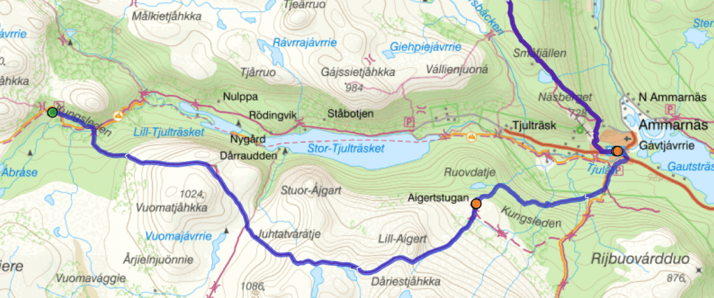
DAY 11 Tuesday 1st July 23.09 km. Rävfalls – Ammarnäs
Beggars can’t be choosers so breakfast was dehydrated pasta bolognaise. Left about 0715. This would be a short day. Around noon we came across an emergency shelter and had a brew and some snacks there. As we arrived there were two Swedish fellows packing up to leave. They were quite chatty. Just as they were departing one of them looked at us quizzically and asked “would you like some Yorkshire tea?” Wow, of course. My favourite tea and what I have at home all the time! He produced a big bag and we tried as modestly as possible to take not too many. It reminds me of the following quote…
“There are no strangers here; only friends you haven’t met yet” Said to be attributed to the Irish poet W.B. Yeats.
The strategically located emergency huts have all you need when in trouble. Wood burner, wood, food, first aid, bed etc. Interesting reading in the log book of someone who had needed it.
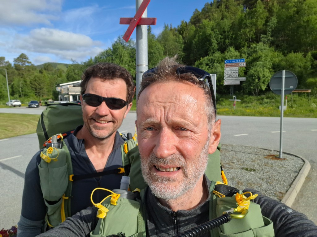
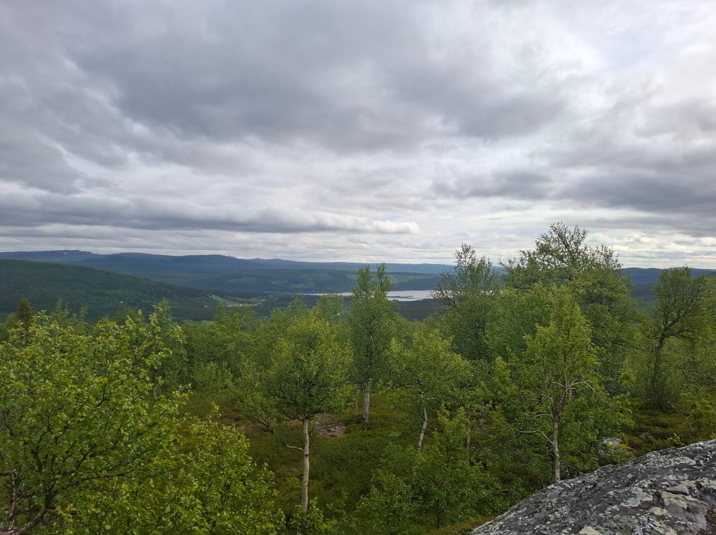
About 1400 we arrived in Ammarnäs, another trailhead connected to a road. It is said to be more geared towards fishing enthusiasts rather than trekkers. So it seemed though we were told 70% of visitors are hikers. We had a nice lunch in a fishermen’s cafe before staying the night in the Ammarnäs STF affiliated guesthouse.


DAY 12 Wednesday 2nd July 28.91 km. Ammarnäs – Serve
Once again a full buffet breakfast with the packed lunch option. We set off refreshed and ready for the final push of the next few days. As we left town we met an elderly man with a bicycle. He was struggling with one of the signs for KL. It was a very old and worn wooden sign on a pole. His intention was to remove, take it home and give it a new coat of paint. We helped him remove the pole which he loaded on his bike excitedly chatting to us about how nice a place Ammarnäs was.
At STF Aigert I got some things from the shop. Carrying on we arrived at 1630 at our destination for the day – STF Serve. We took the option to use the facilities but to camp outside. In the kitchen there were a few fellow hikers. Cammie got the wood stove going and we had a good chat with an American and a Dane.


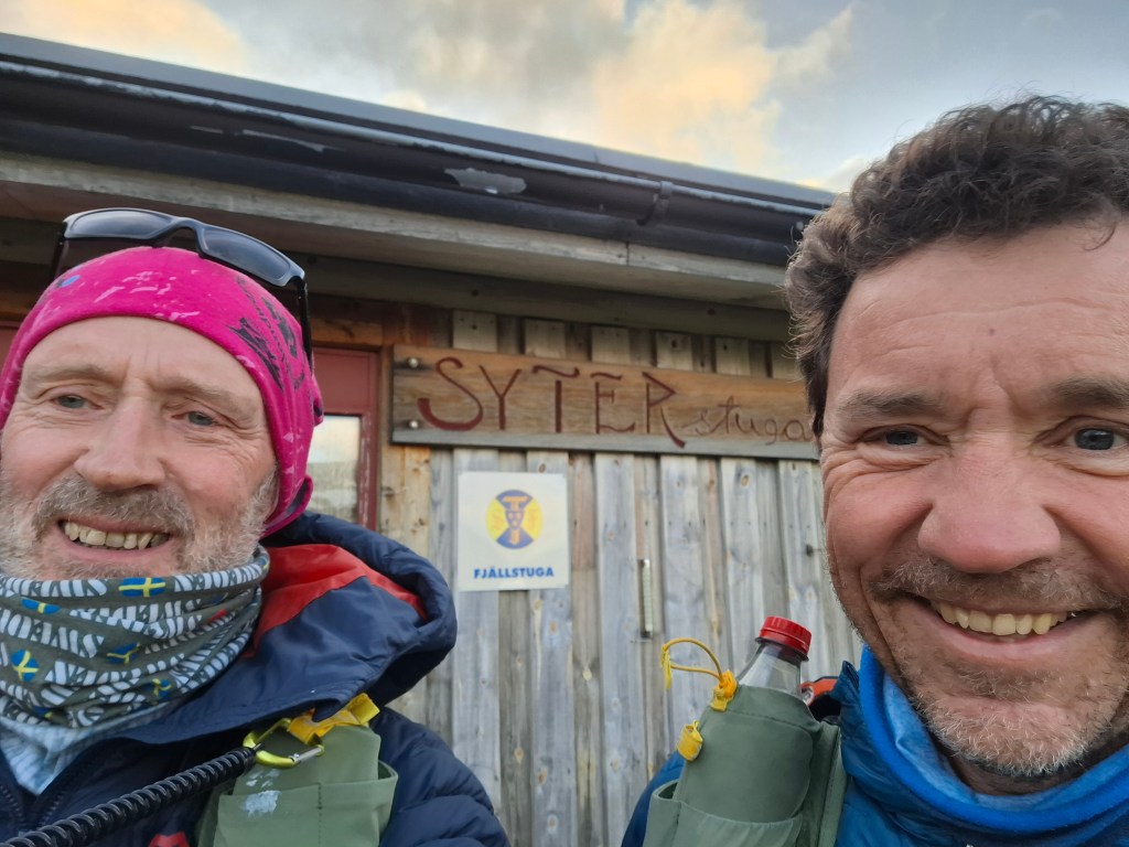
DAY 13 Thursday 3rd July 29.12 km. Serve – Syter

Our penultimate day on KL! Strangely I do not remember many details except for the amazing network of swing footbridges at the southern end of lake Tärnasjön. Arrived at STF Syter in the mid-afternoon and were met by the kind warden couple. They greeted us with lingonberry juice on the porch of the hut. Lovely sunshine but a strong wind. They had for decades spent their summers as wardens. There was no shop but as usual a place where you can pick up left over food and gear from others. Cammie was particularly adept at this. During the trip mosquito repellent, gas cylinders and various foodstuffs were some of his finds. We were assigned a room for the 2 of us where we could bed for the night. It was good to have had a short day as the next day, our last on KL, was going to be a long one.


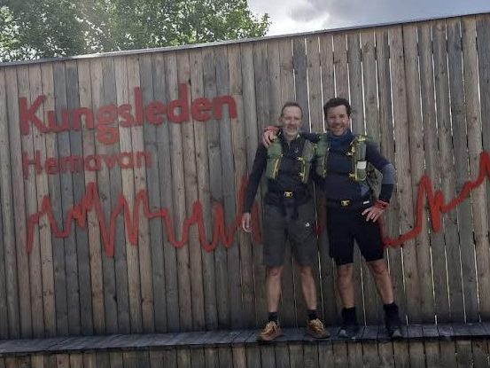
DAY 14 Friday 4th July 24.08 km. Syter – Hemavan
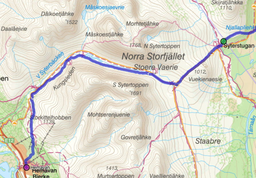
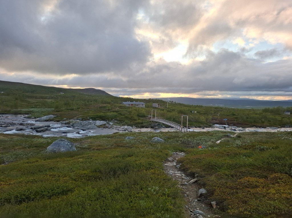
Rose 0330 and left hut at 0420 for last push to Hemavan. We wanted to cover the 24km by mid-morning as we had a bus to catch at 1320. Before boarding the bus we also hoped on spec to get a shower, good meal and clean up. Our final kilometres on the trail also had the promise of going through the dramatic U-shaped glacial valley that is Syterskalet.
The valley delivered a vast ever changing panorama. At an emergency hut Cammie went in he found several sleeping. We had forgotten how early we had departed. Soon we arrived at Viterskals STF, the last stage before our destination. On the porch we had a quick brew and a chat with a Swedish woman who had been a warden at one time.
We were now on our last of 28 stages. The gradual descent into Hemavan seemed to take longer than expected. Maybe we were wanting to savour what we had been through. Trying to take in the scale and the range of experiences of the past 2 weeks. It had indeed been epic. As long and possibly as arduous as some might find this blog!
At 1015 we arrived at the official end of Kungsleden. We had done it. We both realised it didn’t just happen. It had taken months of planning and preparation. Now we could relax. Once again made use of STF which was affiliated with the church in Hemavan to get a shower. From there we went to the local supermarket where we had a superb buffet lunch (‘dagens’ in Swedish). Soon we were off on a 6 hour bus ride to Umeå and then catching a 10 hour night train to Stockholm.


This blog was completed some 11 days after finishing. Looking back it feels we had been living in a different world. A unique environment. It seemed to impress on you its majesty and power. A wild, pure and fragile place. It was humbling to be able to spend time there, to pass through. To wonder at the vastness of the world in which we live. To contrast that greatness with our fragility as human beings. To also be amazed to know that we have a unique awareness of the divine Creator behind all this beauty and complexity. To meet fellow travellers or, if you will, pilgrims travelling that same landscape. Our journeys through life are different. Yet there is a common hunger for the transcendent. Sometimes that call is heard in the still, small voice on ‘the King’s Trail’.
I am grateful as ever for my wife allowing me to have done this. Her support and encouragement before, during and after helped me realise this dream. Thanks also to Cammie for challenging and accompanying me every step of the way.
Related blogs on the idea and preparation behind doing Kungsleden.
Kungsleden (‘The King’s Trail’) – Vision and Kungsleden (‘The King’s Trail’) – Ready
NOTE – If commenting, and wish to be identified, please put your name at end of comment. Otherwise I can’t be sure who you are! Thanks.

It looks like a beautiful place to hike and I’m glad you didn’t have any mishaps. Is it easier to hike with a companion? I know it would be safer and more interesting to have someone to talk too. Do you carry some type of mobile phone devise for outside communication if necessary? Do you do your writing about the trip daily while you are hiking and bush it up later? You seem to remember so much detail about your hikes including how you felt about things. Thank you for sharing the hike and the beauty with us.
Mary Fulton
USA
LikeLike
Hi Mary,
Glad you liked. Yes, nearly always good to have a companion though over 2 weeks we were quite often quite far apart at times.
Mobile coverage was not always there but had a GPS satellite tracker which if needed could send emergency messages.
Usually at end of each day try and scribble some notes of day. Some days more memorable than others!
LikeLike
Well done Allan and Cammie. This was indeed an epic trip.
Some astonishing wild landcapes.
You did it at an impressive pace too.
How did it compare to your Glasgow to Aultbea trek? I suspect about twice the length and much wilder?
Martin
LikeLike
Thanks Martin,
Including the lake crossings about 50% more. Yes much wilderness. Though Fort W to Aultbea passes through remote places its very different. Feel very small in something very big. Happy to chat about it!
LikeLike
Thamks Allan I am already on page 5 having got it off facebook. Really very interesting. Dad
LikeLiked by 1 person
What an epic adventure -wonderful majestic scenery I loved the photos -so much to take in -thanks for the blog-again I can’t get my head around what it takes to be able to plan and execute all of this.
Linda Spencer
LikeLike
Thought I went over the top with scenery pics but the landscape was stunning! Yes took a fair bit of planning but between the 2 of us we each bring different things.
LikeLike
A great read Allan, bringing me right into that amazing part of the world. Thank you for sharing your insights and great photos. You have proved again what an amazing athlete you are!
JimD
LikeLike
Thanks Jim, glad I could ‘transport’ you there.
LikeLike
Thank you for sharing your experience Exhausting for you,but so many experiences to share and the photos are really appreciated A new world for us!!
LikeLike
Hello Sheila,
Glad you liked. It was a new world for me also!
LikeLike
Wow to the power of 10! Congrats to you both on completing this epic journey and to you for bringing it to life for us also. Now how can you possibly top this?
Moira
LikeLike
Thanks Moira, pleased I could convey something of the adventure. Am not currently thinking of topping anything!
LikeLike