
A friend Martin Reid mentioned several weeks ago if I was interested in an idea of his. It was to ‘summit’ every hill in the Kilparticks over 300m in one go. Must admit it was not something I had been dreaming about. In fact if honest it had never even occurred to me in my wildest dreams. However as mentioned in ‘Lockdown Escapism‘ you have to be inventive and creative in the current restrictions so I signed up for it. Now Martin is a man who loves bagging hills. He has done all the Munros* and is on his way to doing them for a second time. I therefore left him to plan the route and locate all the hills, itself quite an obsessive past time.

We set a date and a few days before he sent me the list of hills and in what order. Up to that point in the back of my mind I thought there might be 9 or 10 such. When his forensic list came to 19 it suddenly felt this was going to be a challenge and not just a quirky thing to do. All these hills had names, many of them quite colourfully and we were aiming to set foot on some that were probably little loved and unknown but nevertheless had a name! Berry Bank and Brown Hill seemed realistic descriptions but Thief’s hill, Jesus Thimble and Doughnot hill leave much more to the imagination. Some were completely forested over making the actual summit hard to find. Others were flat, unmarked and featureless also making it debatable where the top is. We would also be guessing what would be best routes between hills as a good deal of the time there was no trail just wet bog or marsh. So overall distance and difficulty was also guesswork. I rather carelessly thought 6 hours would do it with no justification other than it sounded about right.
So last Thursday we set off from Cochno car park at 0930 with me quite happy to trust Martin’s navigation skills. Many of the hills had trig points**, some had cairns and others had no indicators whatsoever. Although technically we were aiming to run, in actual fact much of the time when we were in boggy or wooded areas it was simply plodding through long grass. In order to get to the first and most eastern ‘peak’ we started out on a paved road before making a gradual climb to Jesus Thimble. Halfway to Birny hill (no. 2) we made a small detour to a cairn. It was below 300m but was there for a purpose. Great views sometimes trump ‘great’ height. After no. 3 we made our way round Burncrooks reservoir to head for the intriguingly named Thief’s hill (4) and a struggle to find where it was. I imagined with a name like that it would appear like a hideaway or defensive looking. Instead a featureless, flat plain with no ‘X’ marks the spot.


We were starting to find a common problem in ascertaining which hill was which. Had it not been for Martin’s skills I would have got lost. Was also starting to wonder – it had taken 3 hours to do the first 4 hills. Although these had been far apart we still had 15 more to go. My time estimate was starting to look wildly optimistic. Sunset was 5:40pm. I began to think bringing my head torch as an afterthought had been a wise move. However the 3 Duncolm hills were quickly done so that was an encouragement. The forecast had been good but temperature most of day was not much above freezing and also wet and windy. Even had hailstones on a few occasions. The sun appeared a bit in the afternoon.
From Fynloch hill (no. 8) Meikle Saughen brae (9) looked a long way away over the bog. Amazing how distance in the hills often looks exaggerated. If not careful this perspective can lend itself to the impression that everything is harder than it actually is. What is on the horizon might in fact be only 20 mins. away. 10 and 11 were at the extremities from our start point so when that was done it felt we were turning a corner. Doughnot hill (12) is one of the more visited Kilpatrick hills. Reaching there also heralded sections with less bog and marsh. 13 and 14 I can’t recall much. Craigrestie (15) was difficult to find as it was in the woods and not at all apparent where it was. We had all but decided to give up when Martin reckoned on a way in. Upon reaching a particular tree he stopped and declared it Craigrestie. Who was I to argue.
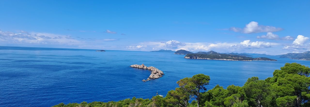
On to Berry Bank (16) where we got a great view of the 3 Duncolm hills lined up in the rare sunshine and which we had done earlier in day.

Then on to the popular Slacks and Cochno Hill (17 & 18). Midway between them at Greenside reservoir stopped to chat briefly with 2 young guys who were just setting out. They had walked from Glasgow and seemed not to be bothered that there was only about an hour of daylight left. Interesting how the hills can make people do things they may not be totally prepared and planned for (speaking to myself). Our last hill was ‘out of the way’ Craighurst (no. 19). It deserves a mention, mainly because it was the last, and not for any aesthetic or majestic impression made upon me. Was grateful to Martin for sharing some welcome biscuits as I had no food or drink left and was starting to feel a bit weary.


Energised we descended to Jaw Reservoir where dusk was quite atmospheric. A clear sky with the moon over the water a good end to the day as we made the final descent down the muddy slopes to the car park. Thanks Martin for planning and navigating what was a memorable day.
* A Munro is a Scottish hill or mountain over 3,000 feet (about 914 metres). There are 282.
** Trig points are concrete pillars placed at particular places usually the tops of hills or mountains.
Excellent journey – one feels that you have been on the trek with you. Also reminds me of climbing the mountains in PNG and actually living at 6000ft above Sealevel. Many thanks,,, Global Nomad…
Wow 19 Munros, you must have been shattered
No, not 19 Munros. It was 19 hills over 300m.
Congratulations, you are both nuts! (But delightful with it…)
Love Moira
Great lockdown walk. Well done Allan and Martin!
I’m absolutely exhausted reading this. Agree with Moira – you are both nuts….!! 🤣🤣
You make me wish I had been there – but I doubt if I could have lasted the pace!